 The major advantage that Britain had in the Battle of Britain was radar – being able to know in advance of enemy planes, their direction, numbers so that British fighters could be airborne and ready to meet the enemy.
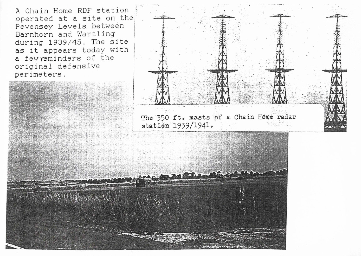
RAF Pevensey was a Chain Home Radar station, one of 190 Ministry Experimental Stations formed in 1938. It was situated to the west of the Pevensey to Wartling road near Newhouse Farm. The other stations in Sussex were at Rye and Poling.
The station had three 360ft high metal transmitting masts and four 240ft high wooden receiver towers. Facilities included ordinary and emergency operations rooms, billets and pill boxes around the perimeter. This station closed in 1956.
RAF Wartling was a Ground Control Interception Station, established in 1941. A large brick and concrete operations building was operational from July, called the `Happidrome’.
The equipment here enabled the Ground Controller to speak directly to the fighter pilots. This station closed in 1964. Accommodation was built at Rodmell in Eastbourne, a camp in the grounds of Herstmonceux Castle on the Wartling to Windmill Hill road and at Bexhill – RAF Northeye.
RAF Pevensey was raided on 12th August 1940 when three enemy aircraft attacked causing some casualties and a direct hit on the NAAFI causing great consternation to the ground staff there!
On 14th August a single aircraft attacked the station hitting the receiver block but the station was able to remain operational before and after the raid.
“Chain Home”, or CH for short, was the codename for the ring of coastal Early Warning radar stations built by the Royal Air Force (RAF) before and during the Second World War to detect and track aircraft. The term also referred to the radar equipment itself, until it was given the official name Air Ministry Experimental Station Type 1 (AMES Type 1) in 1940.
Chain Home was the first early warning radar network in the world, and the first military radar system to reach operational status. Its effect on the outcome of the war made it one of the most powerful weapons of what is today known as the “Wizard War”.
The gallery of images below (click on any image to see a larger image) show: –
Image 1 (left-hand image) – There were three 360ft high masts of the Chain Home radar station at Pevensey similar to those shown on the left-hand image.
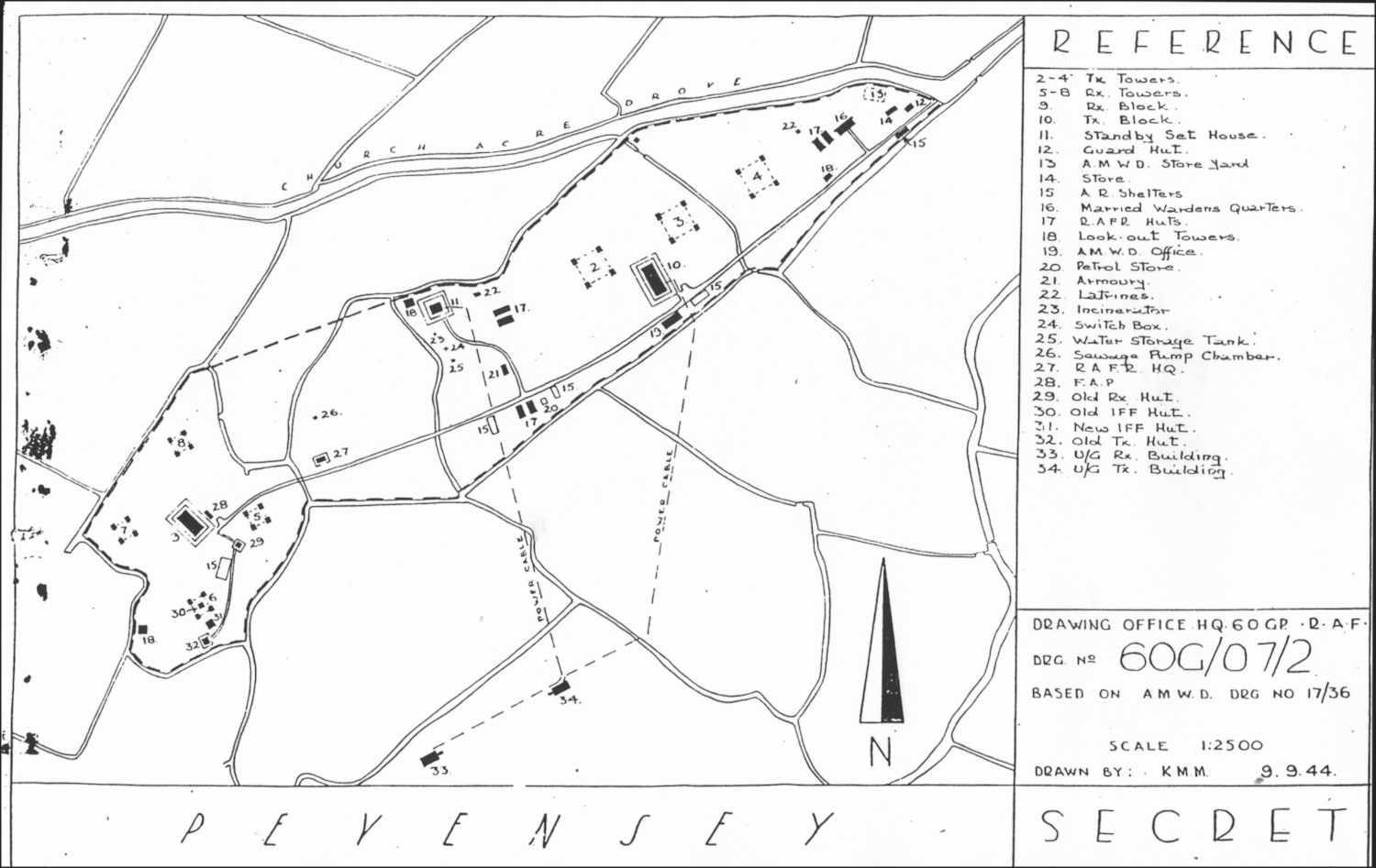
Image 2 (Middle image) – shows a plan of RAF Pevensey in 1944. It is marked secret.
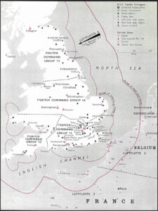
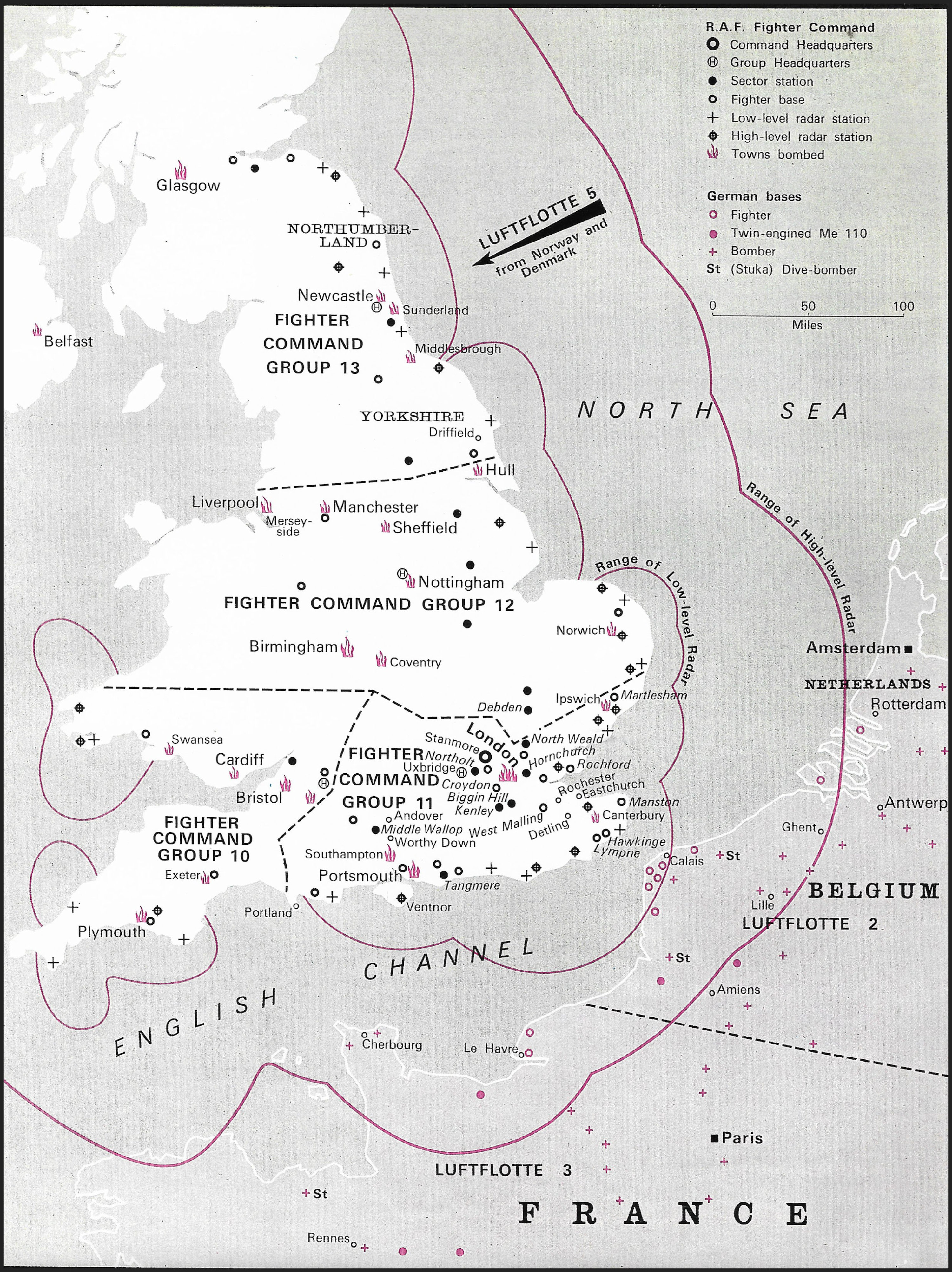
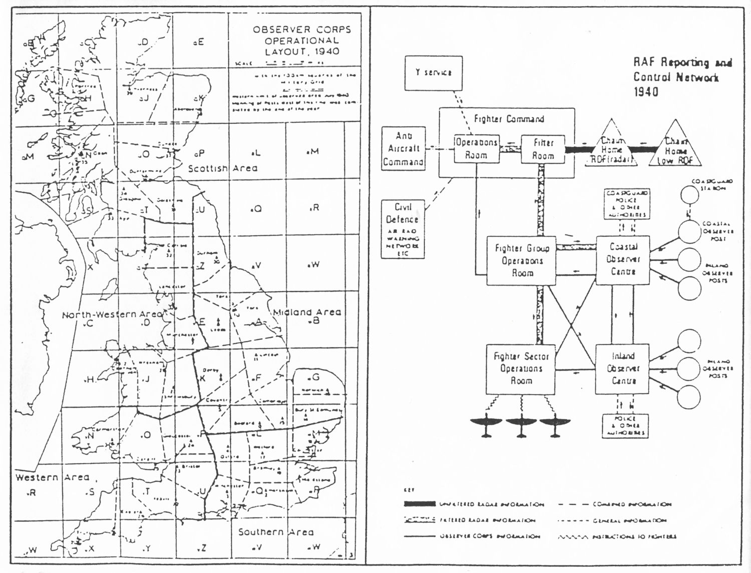
Image 3 (right-hand image) – shows a map of the Observer Corps Operations Unit and a diagram of RAF reporting and control network during the Battle of Britain.
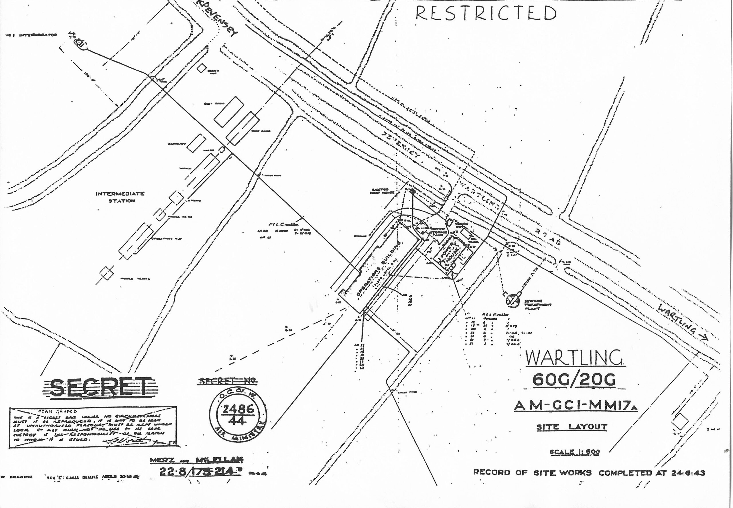
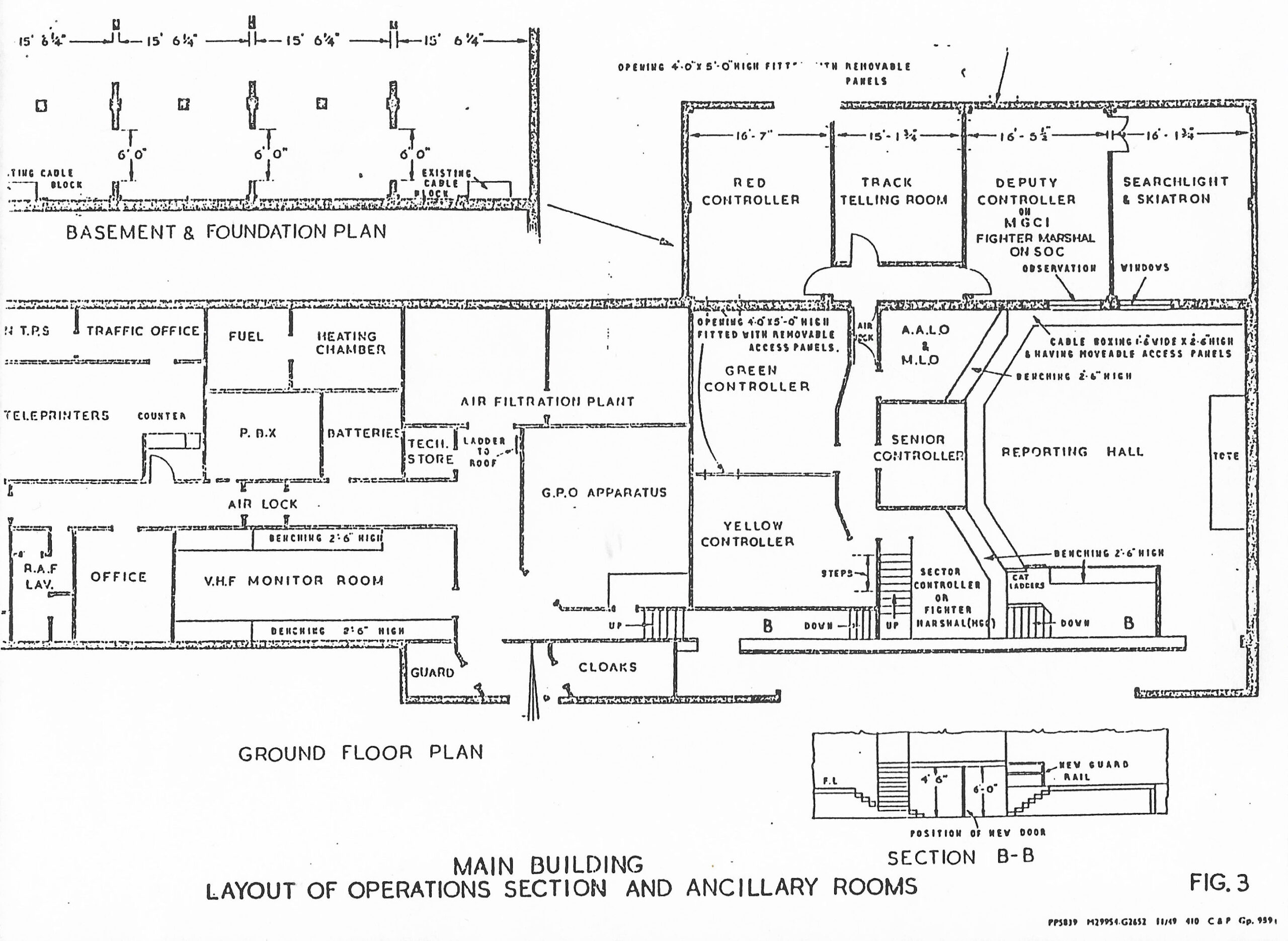
The first image, on the left, dated 24th June 1943, shows the Site Layout of RAF Wartling and marked “Secret”. RAF Wartling was known as the ” Happidrome” by the men and women working there. The second image, on the right, shows the plan of the the main building, the operations section and other ancillary rooms. Note! Click on either image for an enlarged view.
The following comes from Nick Catford a world-renowned cameraman and is probably the most accomplished subterranean photographer working today, specialising in sites of cold-war, military and industrial archaeological interest. He’s also Membership Secretary for the “Subterranea Britannica” website and Wikipedia from which this information comes.
1939 HISTORY – RAF Wartling was a Royal Air Force station located near the village of Wartling in East Sussex. It was a Second World War and later Cold War Ground Controlled Interception (GCI) station built to complement and supercede the nearby Chain Home station at RAF Pevensey that was technologically out of date.
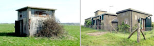
Image on left – This innocuous rendered brick hut, is the entrance to the underground bunker at Wartling. One telltale sign of actual use is the louvers that suggest significant ventilation. The other sign is the concrete roof.
Image on right – The modulator building at the top of Bunker Hill at Wartling, now a residential conversion, seen here in 2004. Gratefully, the works to change to a character cottage have managed to retain the original RAF look, no doubt with thanks from the archaeological community. Well done to the owners.
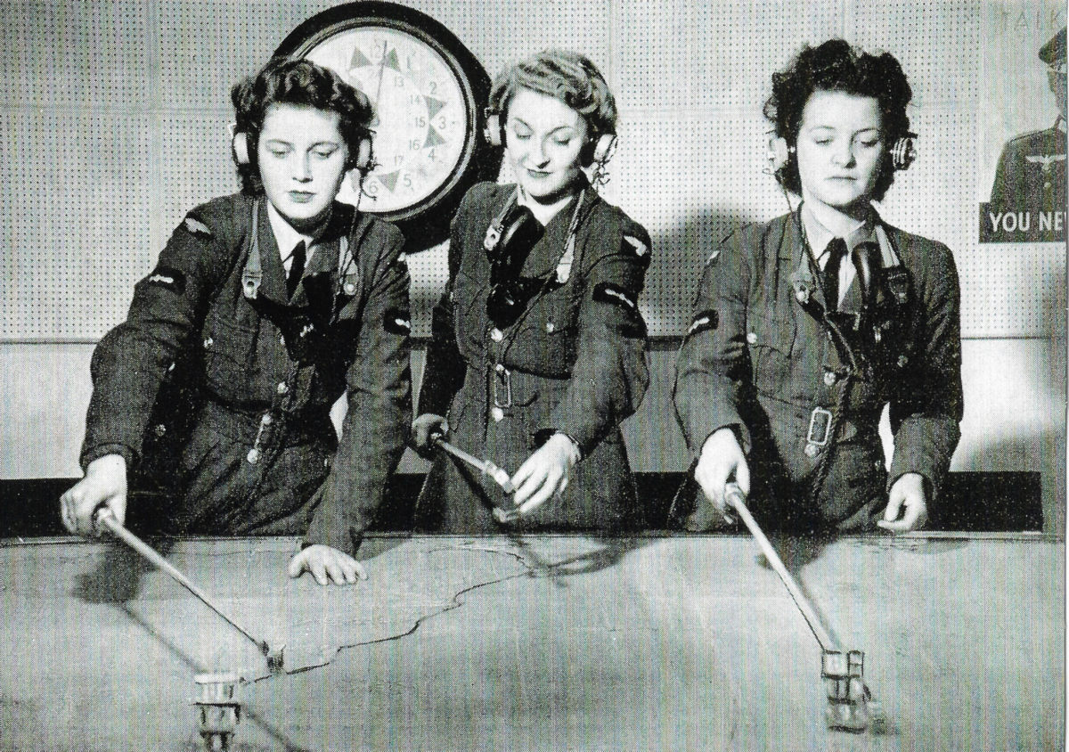
To compliment RAF Pevensey, a new GCI station, RAF Wartling, was built on the opposite side of the marsh road, becoming operational in 1941. RAF Pevensey acted as an early warning station, detecting hostile aircraft. The station reported to the filter room at Bentley Priory and thence to 11 Group HQ at RAF Uxbridge (responsible for the SE corner of England) who would scramble the nearest aircraft for RAF Wartling to control. The Ground Controller working from his PPI (Plan Position Indicator) display screen would be able to talk directly to the pilots of the fighters they were controlling, giving them directions to intercept the enemy aircraft that were within the range of the aircraft’s own intercept radar.
1941 SECOND WORLD WAR
Wartling became operational in 1941 and was used to control fighter aircraft and guide them towards approaching German aircraft. Originally based in caravans the station had a brick-built operations block that came into operation in July 1943. Wartling helped track and destroy 380 German V1 flying bombs. Although the nearby RAF Pevensey had closed in December 1945, Wartling remained open as one of the few remaining GCI stations in the South of England.
The GCI station was established in three stages: ‘mobile’, ‘intermediate transportable’ and ‘final’. Early stations (from 1940) had equipment on wheeled caravans and temporary wooden hutting; these were replaced by intermediate stations which had the aerial arrays mounted above and below a wooden gantry, with operations carried out from woode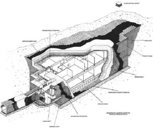
 n huts.
Final stations, built from 1942, had brick operations blocks, known as ‘Happidromes’. These stations had a single Type 7 rotating aerial array with the transmitter and receiver housed in a well underneath. The happidrome became fully operational at Wartling in July 1943.
It is recorded that a total of 380 German V1 ‘doodlebug’ flying bombs (see below) were tracked and destroyed following detection and interception by RAF Wartling personnel.
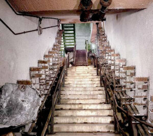
The image on the right shows one of the entrances to the bunker – seen in the diagram below at the bottom left. There is a block built shed above ground leading to the steel staircase, then the concrete steps. Note the rows of empty cable support brackets, now stripped of electrical cables. Pity.
Above, a nice drawing of the underground bunker at Wartling by Jason Blackstone. The author recalls entering the complex by a series of steel staircases shown at the bottom left, then going down concrete steps, turning left into the main corridor, via twin swing doors. It is a shame that this interesting industrial complex was not preserved intact for viewing by schools and colleges, etc.
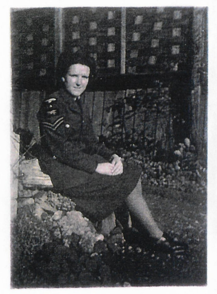
RAF WARTLING PERSONNEL