Introduction
The development of Bexhill-on-Sea as a fashionable late-Victorian resort was very rapid. For centuries’s the inland settlement of Bexhill village (or the Old Town, as we now know it today.) remained largely unchanged. Then, in 1883, the seventh Earl of De la Warr began to transform his rural estate into a seaside town.
The Earl was receiving very little income from his Bexhill estate and was, perhaps, encouraged by the Duke of Devonshire who had developed Eastbourne. Some of the plans here show what the Earl originally wanted the new resort to look like but what was actually built is entirely different.
This exhibition looks at the development and fragmentation of the larger states in Bexhill through the medium of maps, plans, photographs and sales particulars.
Most of the material is presented chronologically but there are many ways to view this exhibition. The maps and documents contain a wealth of information about the town, perhaps you can find your house, where you work, go to school or even a place you once visited which no longer exists
Population of Bexhill
The first rapid increase was due in the last two decades of the 19th century. Another steep rise occurred in the 1950s and 1960s. In this period the age in balance became more apparent, especially amongst the female population, with a marked predominance of the over-60s.
This trend is also reflected in the births and deaths graphs. The number of births is not appreciably altered since the beginning of the century, but the number of deaths since 1950 shows a marked increase.
Population of Bexhill
- 1891 – 5,206
- 1901 – 12,213
- 1931 - 21,229
- 1961 - 28,941
- 1991 - 38,905
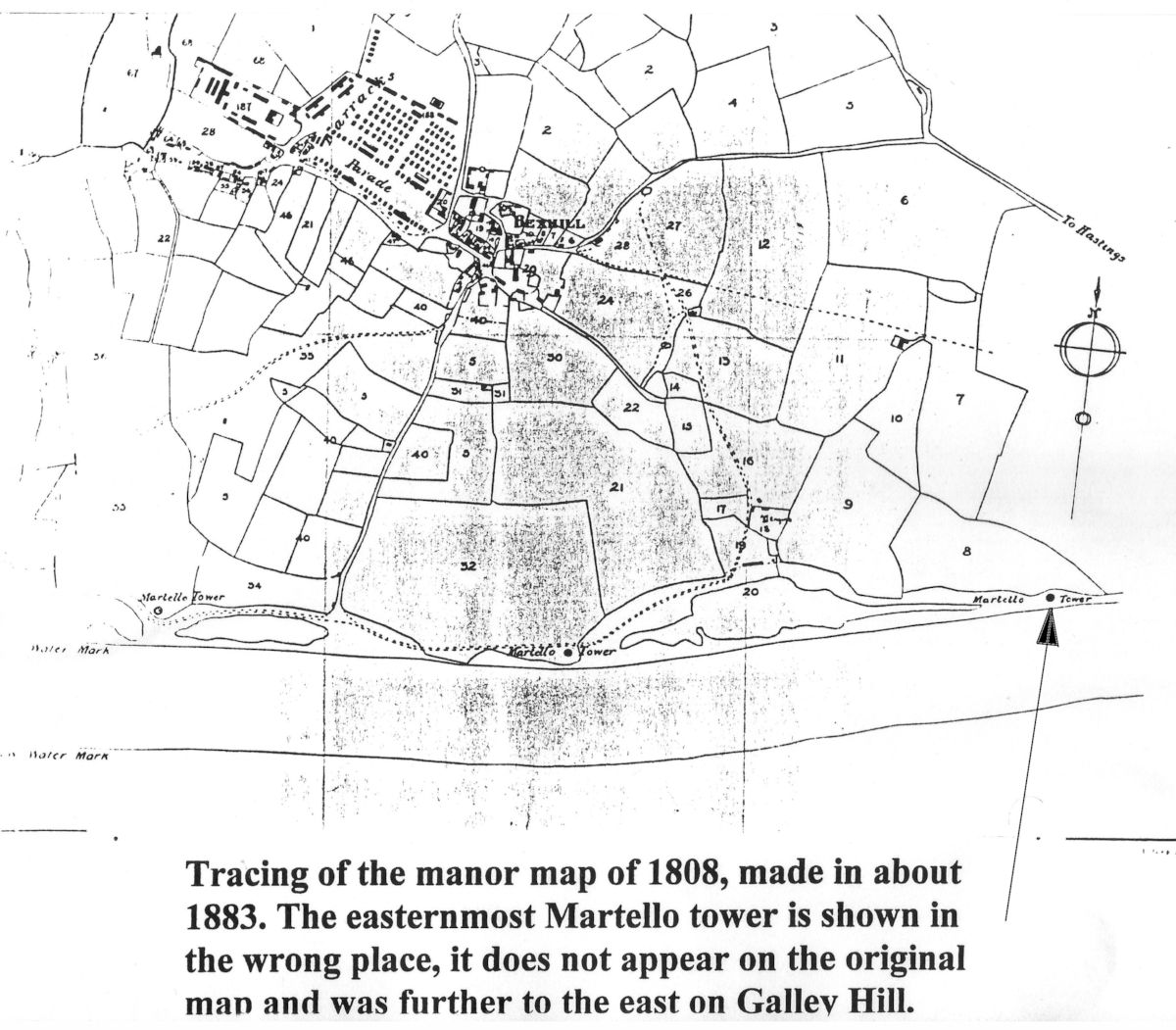
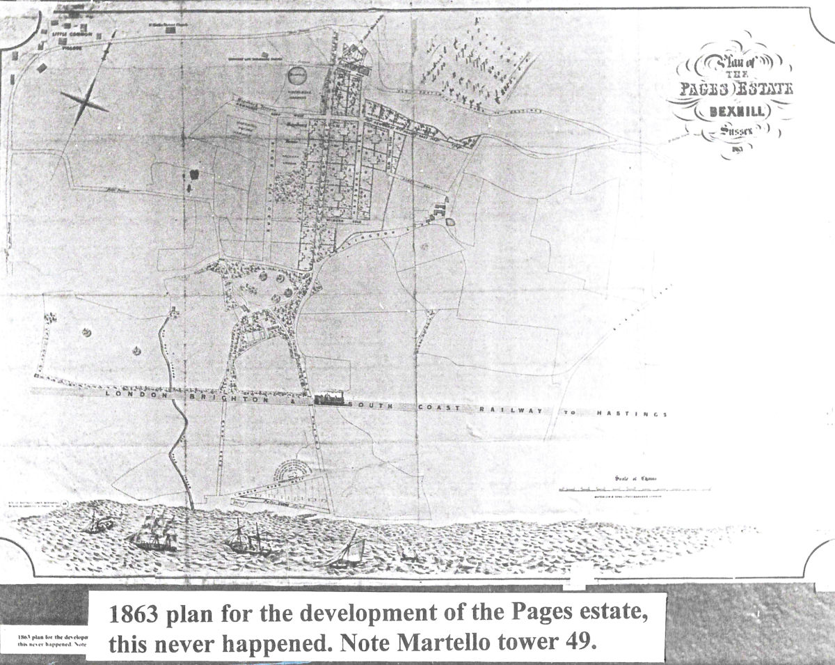
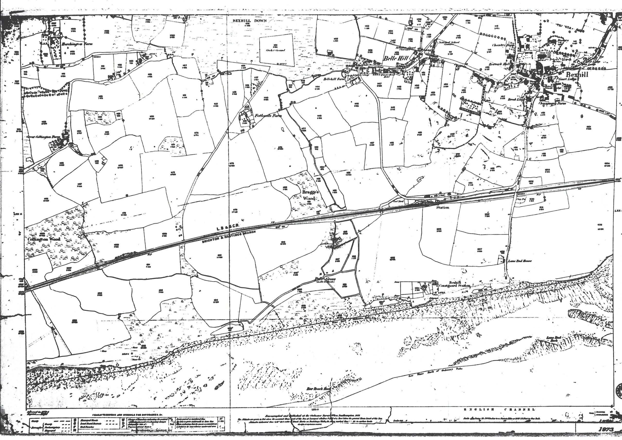
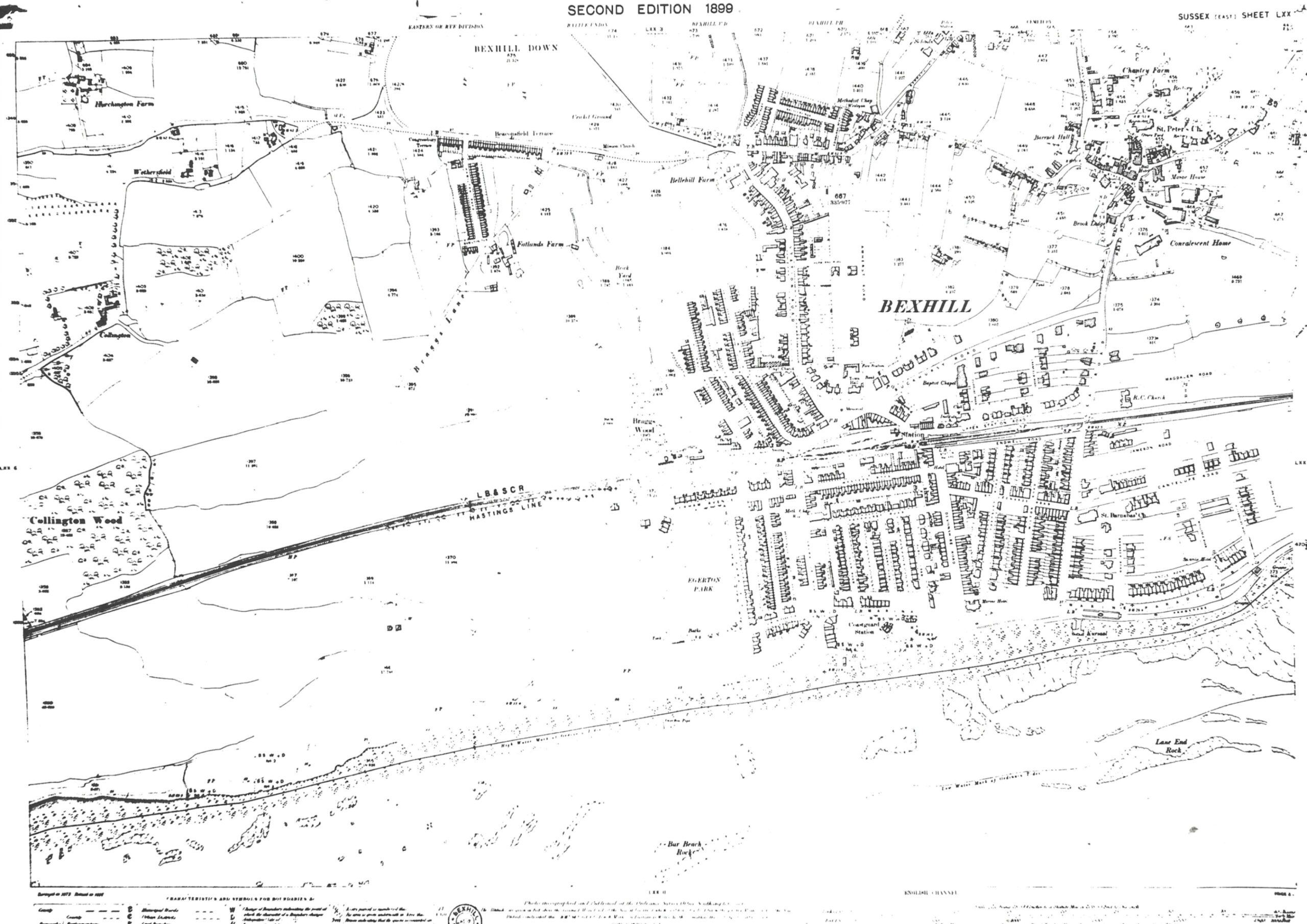
Development between 1808 and 1898
Two maps which show the development of Bexhill between 1863 and 1898. The first map, of 1808, shows the proposed development of the Page's Estate, which never happened. The second map is a tracing of the manor map of 1898.
Note. Click on the images to enlarge, click again for further enlargement and, at bottom right of the image is a button to close the map and return to the main history.
Early Development 1863 – 1927
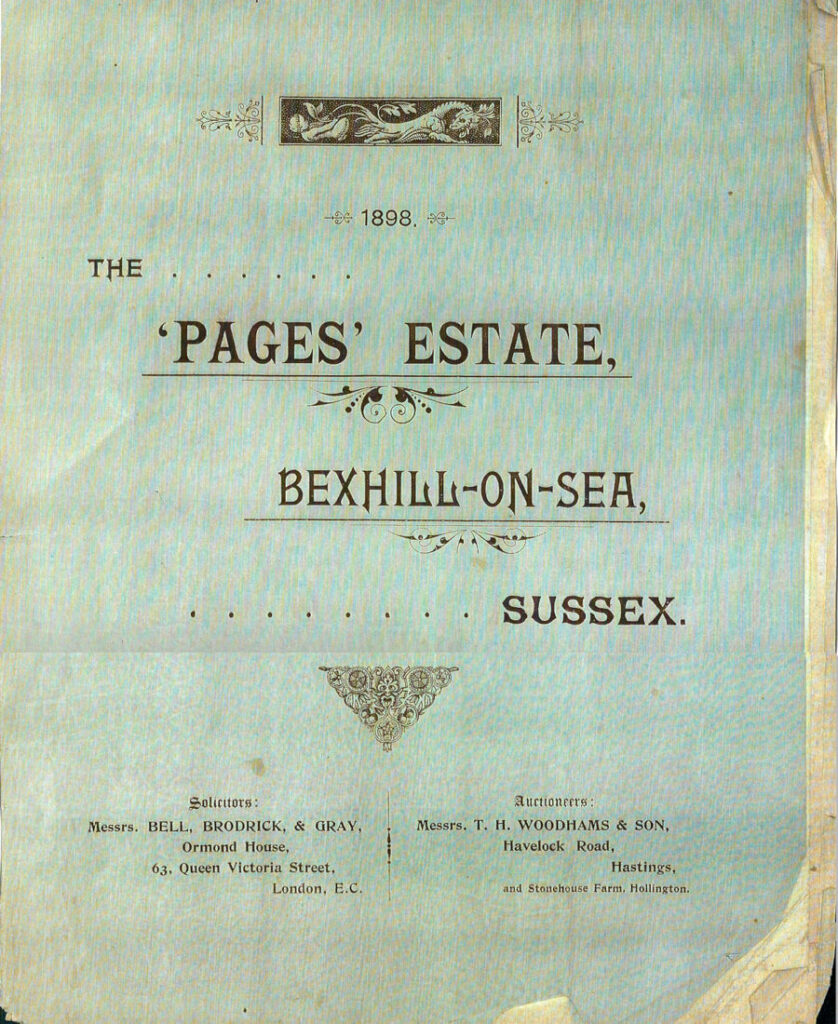
Pages Estate
It was on the area known as Pages Estate that a first attempt was made at expanding Bexhill. The land was owned by the Fielder family but the planned expansion failed to come to anything. After WW2, Pages House was demolished and the land sold for housing development (mainly bungalow). All that now remains of the original estate is Page's Lane.
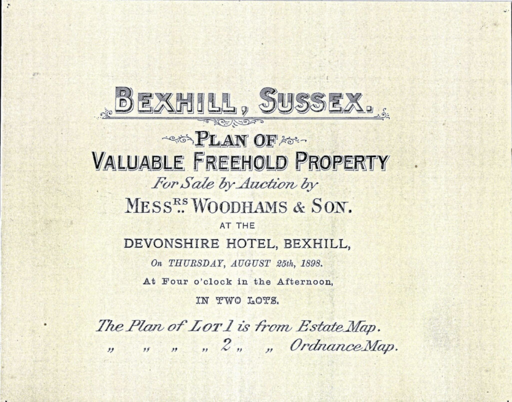
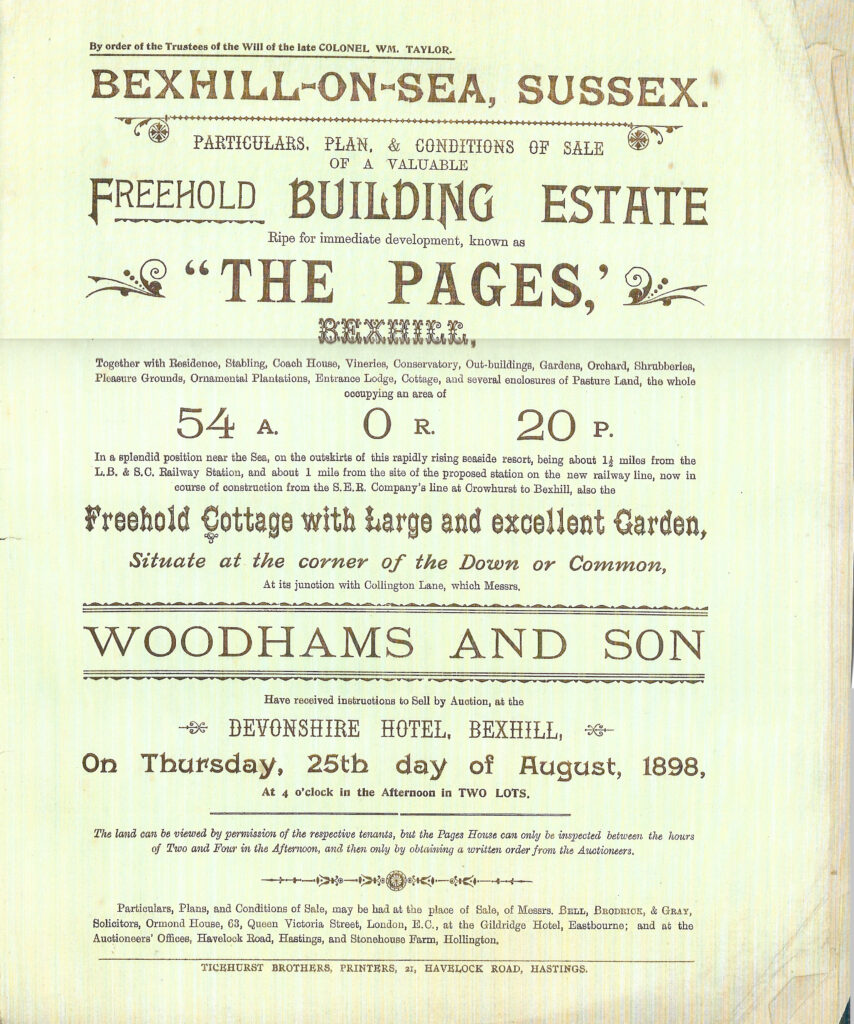
In Downsborough;s map of 1887 (please see below) only the buildings drawn in black existed at that time. The 7th Earl de la Warr's plan for development on the eastern side of Bexhill did not go as planned . Note the proposed pier indicated on the map.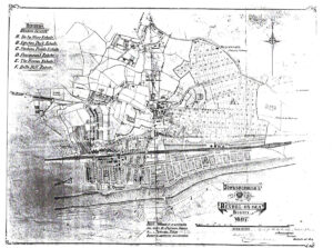
4 - Early Settlements & Early Urban Development
Urban Development
Extension to the Belle Hill settlement in the early 1880s.
Extension to the Holliers Hill settlement - Honies Estate from 1881 onward.
After widening the footpath south of Belle Hill (the present London Road) Samuel Scrivens developed the Station Fields Estate, which became a professional and business centre by 1887 (Castle Hotel 1887; list of shops)
Plots sold by the De La Warr estate in the early 1880s for £250 - £520 for large substantially built Victorian villas as "residential overspill for Hastings businessmen" resulted in the Fairmount Estate, east of the "Old Town".
First Building Boom between 1896 & 1900
Station Fields Estate
Samuel Scrivens was born on 24th February 1841, in Pentonville, Middlesex. He was the son of George and Frances Elizabeth Scrivens. The census of 1841 shows the family living at 7 Clapham Common and it was around this time that he met Ann Moorman Hodson, who was later to inherit the property of the brothers Thomas and Josiah Moorman.
These two brothers had already inherited 'The Firs' in Bexhill, and, by 1847, they had started to purchase additional copyhold land in the area. Copyhold land was a form of land tenure in England that allowed the Moormans to buy, hold and profit from land on the Earl's estate, without the Earl formally surrendering his actual ownership.
.Josiah Moorman passed away in April 1863 and the Moorman Estate was inherited by Ann and her husband. (Samuel Scrivens) Shortly after that that the family left London and moved into the Firs, where they would stay for the remainder of their lives together.
The Sackville family had started to convert copyhold tenancies into freehold in order to increase their income from the land. Knowing this, Samuel Scrivens quickly enfranchised the deeds that he held in copyhold in the area (including the Firs).
He began to develop the land that he held (situated between Belle Hill and the original train station), laying down a track that would later become London Road. This was the first urban expansion outside the confines of the original village and made Scrivens an important figure in the area.
Samuel quickly started to exert his influence in the town, initially by petitioning the Battle Board of Guardians for better sewage systems in the village. A typhoid outbreak in 1880 and continued pressure from prominent figures resulted in the formation of Bexhill’s first Local Board. The board became responsible for the development of the town and the health and education of its citizens and one of the first members of the board was Samuel Scrivens.
With better sanitation, Samuel Scrivens was able to widen the footpath to the railway, and further develop the ‘Station Field Estate.’ He began to sell building plots for the erection of habitations and shops along the new road, and by 1885 it was a thriving business centre for the town.
The importance of the London road centre was short lived however. Other developers quickly moved in, most notably John Webb.
Having completed the Sea Wall in late 1883, and in possession of large swathes of land to the south of the railway, John Webb started expansion on an enormous scale. Most of the ‘new town’ would be laid out within a decade. Starting with Western Road and the Egerton Estate, quickly followed by Devonshire Road and St Leonards Road, the attraction for new residents shifted, as did the business area.
Samuel Scrivens died in October in 1898 aged 82. His estate (which included The Firs, Genista House, Chantry Cottage, Chintings, Sycamore House and Hillside House) would be divided up between his three daughters. Margaret, Ann and Maria would remain associated with the old town well into the 20th Century, and Samuel Scrivens labours can still be seen around the town to this day.
Landowners of the Victorian Parish
A return of landowners presented to Parliament in 1873 showed that land in Bexhill was owned by just a few people.
The largest owners were the De La Warr family. The entire estate came to the 5th Earl by marriage.
The Lane family was another leading landowner. Colonel Lane was one of the first members of the Local board in 1884 and became chairman of the Urban Council in 1895.
The land owned by Samuel Scrivens stretched over what is now London Road and Amherst Road. For some years he was treasurer of the Bexhill Soup Kitchen.
James Lambert Walker of Woodsgate, a large scale landowner, donated the site for St Stephen's Church. He also built a working men’s club and a row of almshouses.
Arthur Sawyer Brook, member of the Local Board and Overseer of the Poor, owned farm land on which the convalescent home was built in 1883.
Much land was also held by the Brassey family of Normanhurst Court, Catsfield. Several of its members played an important part in the affairs of the borough.
The 4th Duke of Cleveland acquired land in the Barnhorn area when he bought the Battle Abbey estate from Sir Godfrey Webster in 1857. The estate returned to the Webster's in 1901.
Of the two images below, the left hand one is taken from the O S Map of 1873 and shows Bexhill ten years before development began. The Coastguard cottages are on the site now occupied by the De La Warr Pavilion. The right hand image shows the way that the fashionable new resort has extended in just 26 years. Very little of the West Parade exists at this time.
Woodsgate Estate
By 1880 building started on the Woodsgate estate of John Lambert Walker on the hillside of the Honies. However, London Road, running to Sidley, was not completed until 1928.
During the 1880s many landowners developed their estates, partly because of the depression in English agriculture caused by imports from Canada and the USA.
The De La Warr Estate in Bexhill
Part of the settled family estate of Earl De La Warr, the title commenced with a settlement, prepared under the direction of the Chancery Division of the High Court of Justice, dated 30th January 1877.
In 1882 the Trustees of the De La Warr Estate obtained a licence to build a sewerage system, a seawall and an esplanade. Mr John Webb undertook the contract for £34,000.
Building on the De La Warr estate remained spasmodic until the late 1890s, when George Herbert Gray, agent of the De La Warr estate for 30 years, laid out Dorset, Magdalen and Manor Roads, obliterating the old cricket field.,
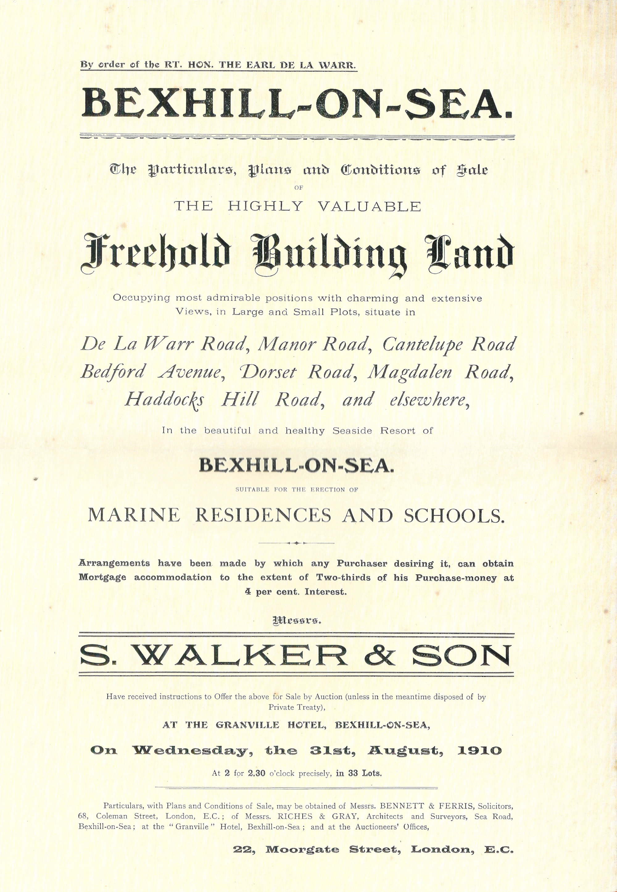
On 31st August, 1910, Earl De La Warr put more land up for auction, this time in De La Warr Road, Manor Road, Cantelupe Road, Bedford Avenue, Dorset Road, Magdalen Road, Hadocks Hill Road, and elsewhere. (Click to see auction advertisement)
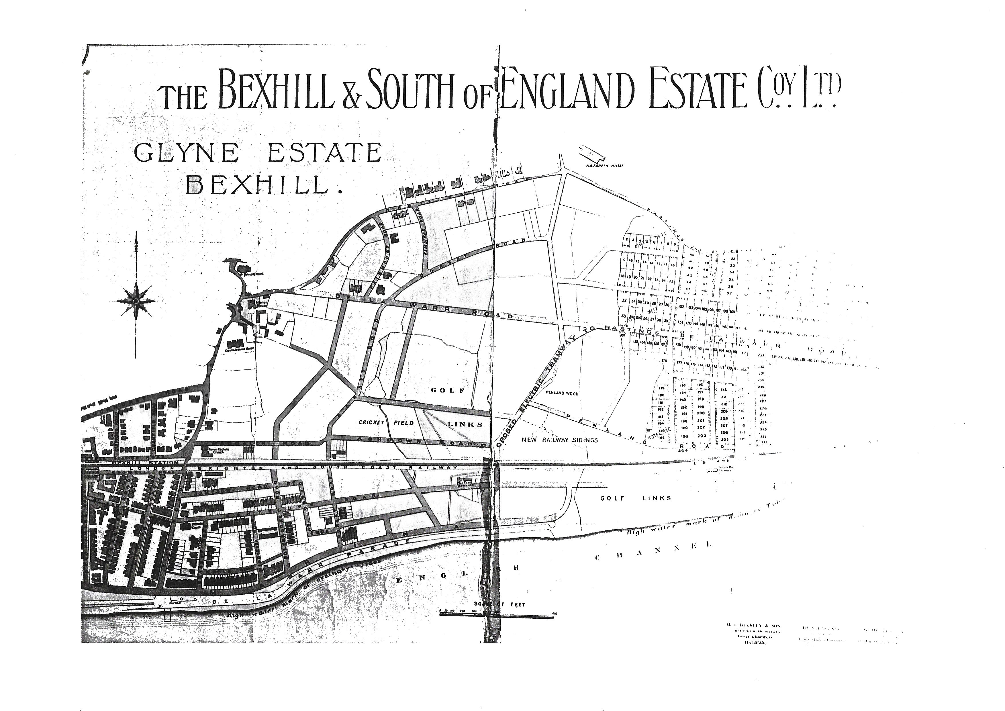
Glyne Estate
The Glyne Estate map (click link to see map and click again to expand) shows the development, on the eastern side of Bexhill, as proposed by the Bexhill & South of England Estate Co. Ltd. Knownas the Glyne Estate it was, however, never built.
George Herbert Gray
A resident of Bexhill he was an architect and partner in the firm of Riches and Gray, estate agents.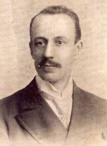
George Gray's contribution to the early 20th century development of Bexhill was as an architect and as an agent, for some 30 years, for the De La Warr estate. and as such was much involved in the creation of Bexhill-on-Sea. He was responsible for laying out Dorset, Magdalen and Manor roads
He envisaged east Bexhill as the prime area for development. His interest in this area reflected in the siting of the Bexhill Police Station and the Magistrates Court at the far eastern end of Cantelupe Road. Gray hoped that this area would become the centre of the new town.
In 1901 he was the architect of St George's Presbyterian Church in Cantelupe Road. His work for the De La Warr estate involved him in more prestigious buildings in the town. .
He had much to do with the Speed Trials of 1902 when his efforts in organising an improved road alignment and surface along East Parade enabled the event to proceed. . He also designed the war memorial at St. Mary Magdalen's Church. and was one of the first professional men to open an office south of the railway in the developing Bexhill-on-Sea. One f his first duties as mayor was to proclaim the Armistice on 11 November 1918. He was also an early member of the Executive Committee of the Bexhill Museum Association.
His efforts to develop Bexhill eastwards were largely frustrated by the presence and proximity of the Bexhill Gas Works, which opened in Ashdown Road in 1887, and the speed with which
He was much involved in local politics and became an Alderman - in 1918 he was elected Mayor of Bexhill. He died in 1929 and his obituary acknowledges particularly his contribution to local government.
John Webb
John Webb was a south London builder and contractor. He became interested in the late 19th century developments along the south coast and in 1883, he was employed by the De La Warr estate 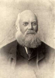 in the building of a sea wall between Galley Hill and Sea Lane (now Sea Road). The estate then employed him to build the eastern esplanade.
As part payment for this work he accepted land west of Sea Lane and south of the railway line. This land was an undeveloped marsh area, but the De La Warr estate saw it as a possible site for lower cost housing.
John Webb then changed the face of the town by rapidly developing this land and by building the western esplanade. He was responsible for the siting of Western Road and Devonshire Road. He became the first licensee of the Devonshire Hotel, but sold this in 1892 and thereafter concentrated on developing 'his' part of the town.
He drained the marsh land and was responsible for setting-up Egerton Park and its surrounding estate. In 1912 he sold the land, now known as the Polegrove, to Bexhill Corporation. This was then used as a waste disposal arefor land filling and later made into playing fields.
In his development of west Bexhill he moved into building a `superior' residential district which competed with the De La Warr estates in the east of the town.
Some of the street names in west Bexhill show the influence of his south London origins; the road between Polegrove and Egerton Park being named Brockley Road.
John Webb came to the town when he was 41. In his early years in Bexhill Mr Webb described it as a place of fields and moorlands bestrewn with gorse and blackberries. When he came to live here he resided for many years at The Pages off Collington Lane.
On Mr Webb's 82nd birthday on 3rd June 1922 he invited his employees at both Brockley and Bexhill to luncheon at the Devonshire Hotel. Several of the guests had been in Mr Webb's service for nearly half a century. He died later in 1922 leaving many mourners; he was a highly respected gentleman.
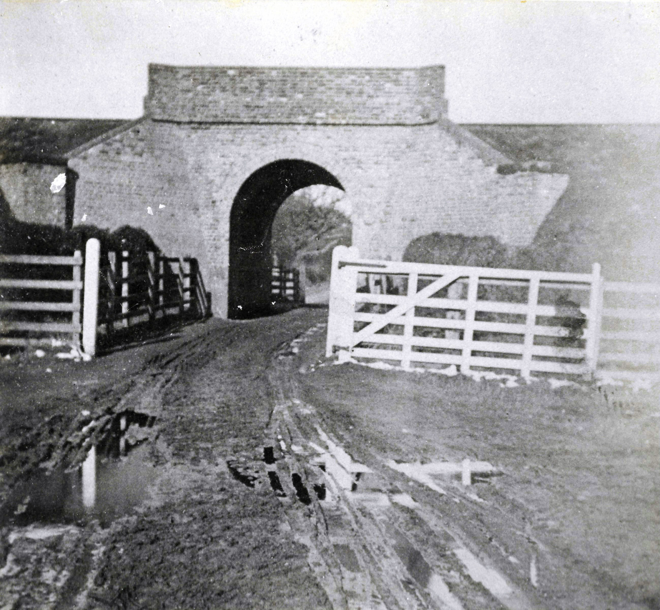
Access to Land South of the Railway
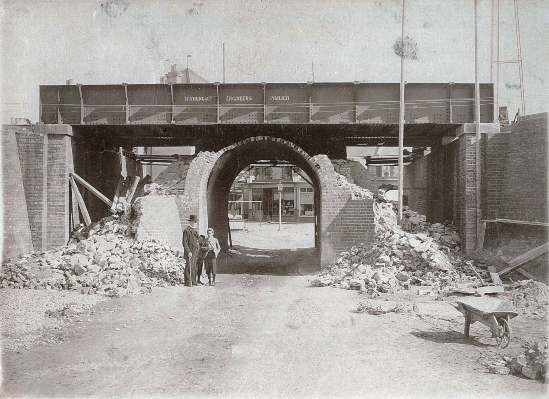
The Sackville Arch, which was enlarged from a cattle arch (a underpass for the railway) in 1892, facilitated the development of the area south of the railway.
The narrow bridge further along at Sea Lane was widened, in 1905, for the tramway service from Hastings to Cooden.
Bexhill's Pier Projects
Several schemes were put forward but none ever came to fruition.
1887 - First proposal for a pier was off West Parade, opposite the later Clock Tower.
1896 - Lord De La Warr's development of the Kursaal was intended as the first stage of a pier.
1898 - The Pier Company (Bexhill) Ltd planned a pier near Egerton Park. The proposal contained a pavilion, concert hall, bandstand, refreshment rooms and shops.
1907 - A jetty of 1,000 feet long opposite Devonshire Road, with a circular promenade, bandstand and raised platform to seat 1,500 people.
Map of Bexhill-on-Sea c.1900
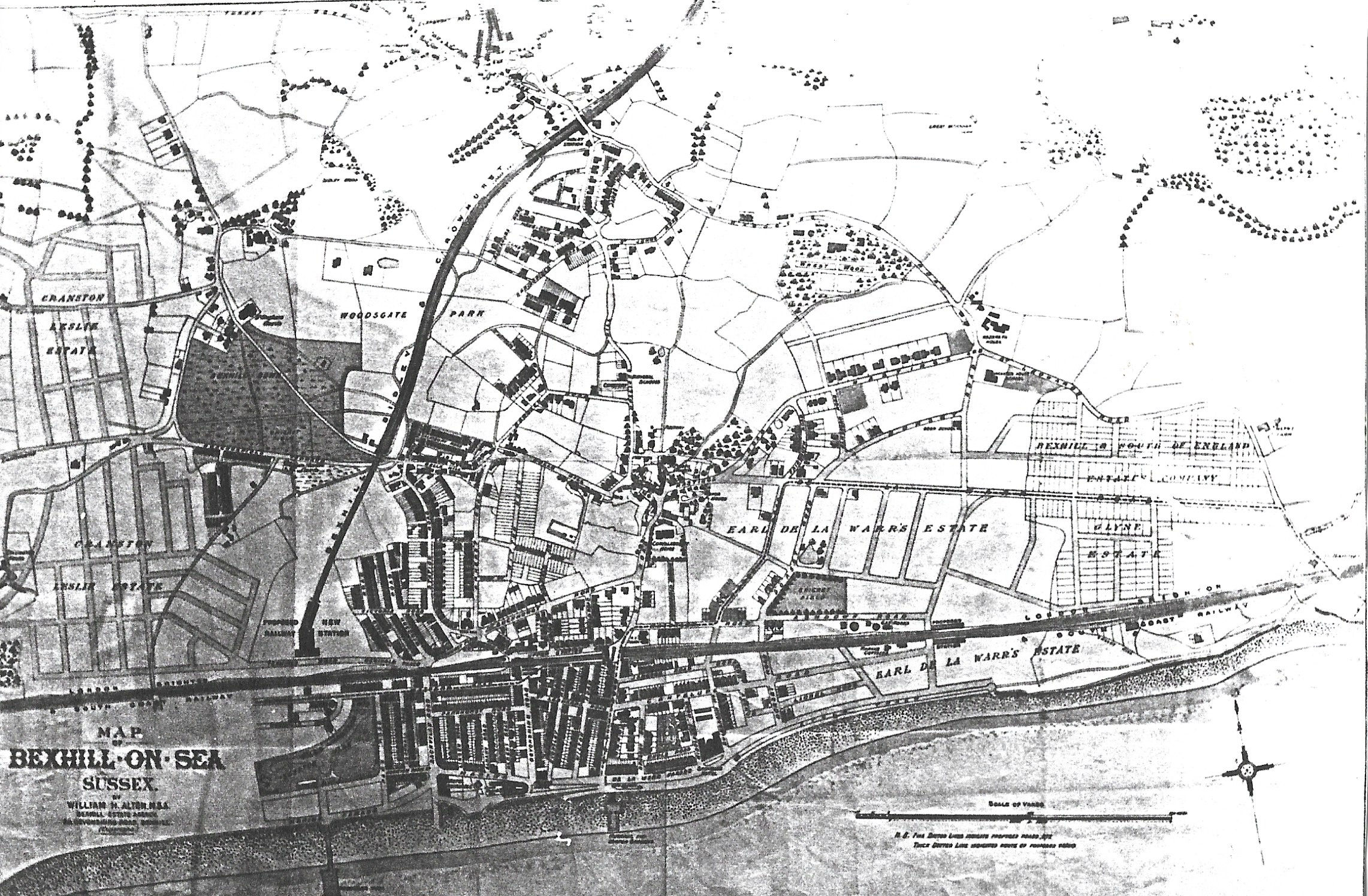
The Crowhurst Line is shown. Another unsuccessful attempt was made to develop the Glyne Estate at this time an proposals were made for a pier and an extended Kursaal.
Bexhill's Sea Front
The first parade and sea wall was built in 1883 by John Webb for the De La Warr estate between Galley Hill and Sea Lane.Webb was given land on the western side of town where he built a similar sea wall along the Egerton Park estate.
The Town Council controlled none of the sea front until 1895 when the section between the Coast Guard Station and Sea Lane was acquired.
In 1901, the Council took over the West Parade from John Webb. By 1903, the western parade was 2410 feet long with gardens, a bandstand and four shelters.
Coastal erosion caused much damage and in 1910 part of the West Parade collapsed. Later the remains were blown up by the Royal Engineers. The new wall from the Clock Tower to the end of the parade was completed in 1911.
The Central Parade was opened in 1910. The Colonnade, opened in 1911 by the Earl Brassey in commemoration of the coronation of King George V, marked the unification of the western and the eastern parades.
The East Parade remained under the control of the De La Warr estate until 1913. This was the fashionable area with its cycle track (opened in 1896), the motor races (which started in 1902), the Kursaal, gardens and fine hotels.
It was not until 1935, when the Council acquired the Kursaal, that the whole of the sea front was under public ownership.
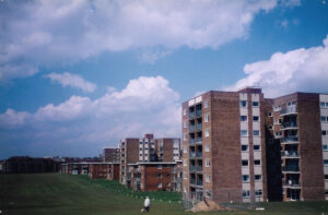
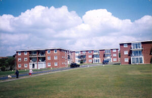
Sutton Place
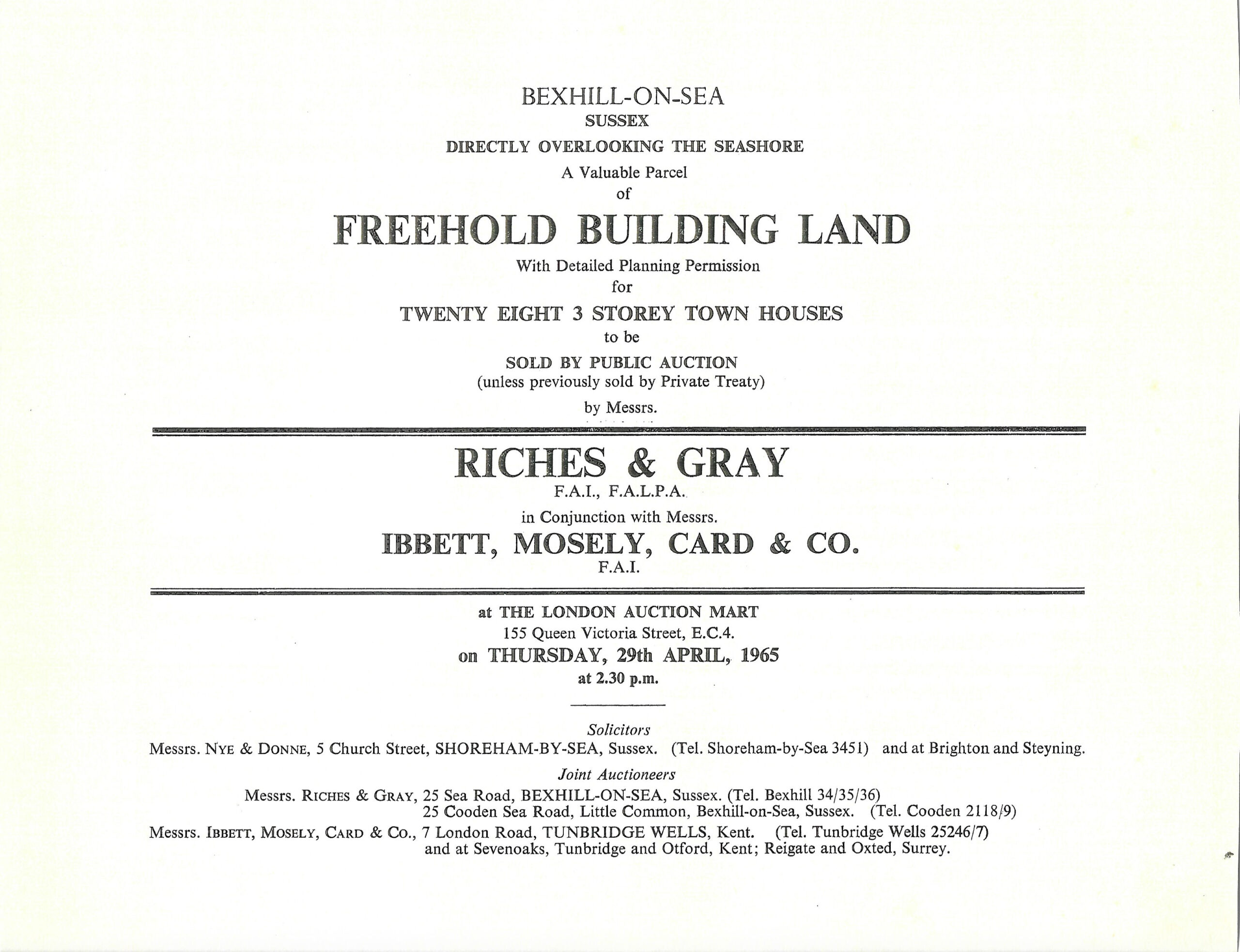
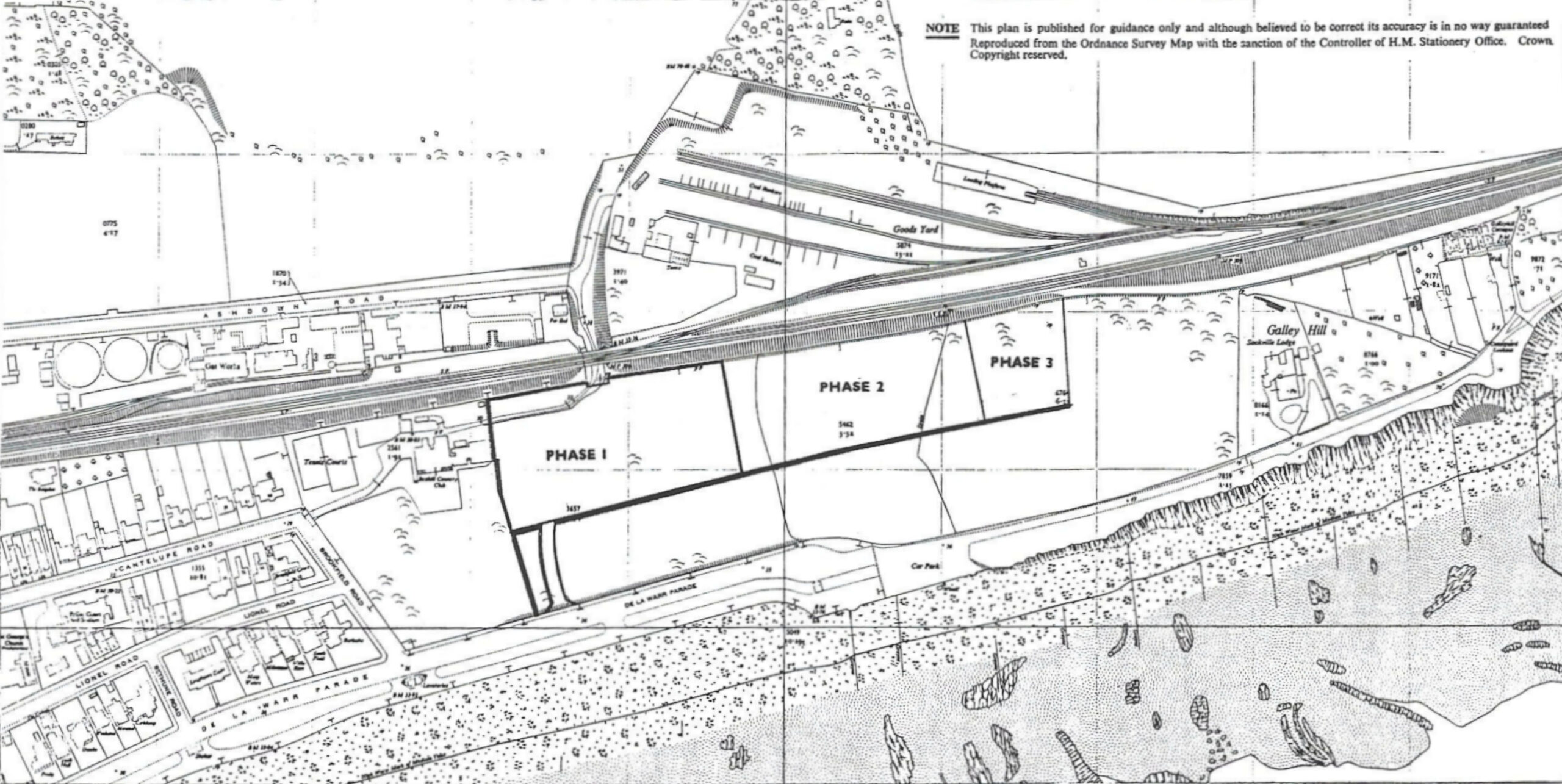
It's not known who the developer of this part of east Bexhill was but Sutton is a borough in south London and all the names of the apartment blocks are locations in either south London or north Surrey. Did he have a connection with Sutton?
Item 1 below shows an advertisement for an auction, in 1965, for land at Sutton Place and the second image is a map showing where the areas of phase 1, 2, and 3 of this development were. Click on the images for enlarged versions.
Looking at the two images the land for auction obviously relates to the buildings in the second images
Two types of buildings on Sutton Place.
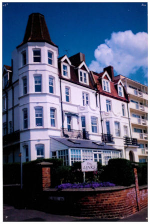
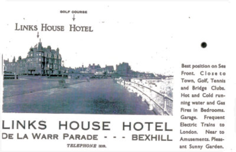
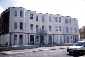
Links House Hotel
Wartime Bexhill
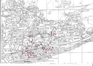
Between August 1940 and the end of hostilities in Europe in May 1945, Bexhill had had 51 air raids by piloted planes, 328 high explosive bombs and some thousands of incendiary bombs dropped on the town.
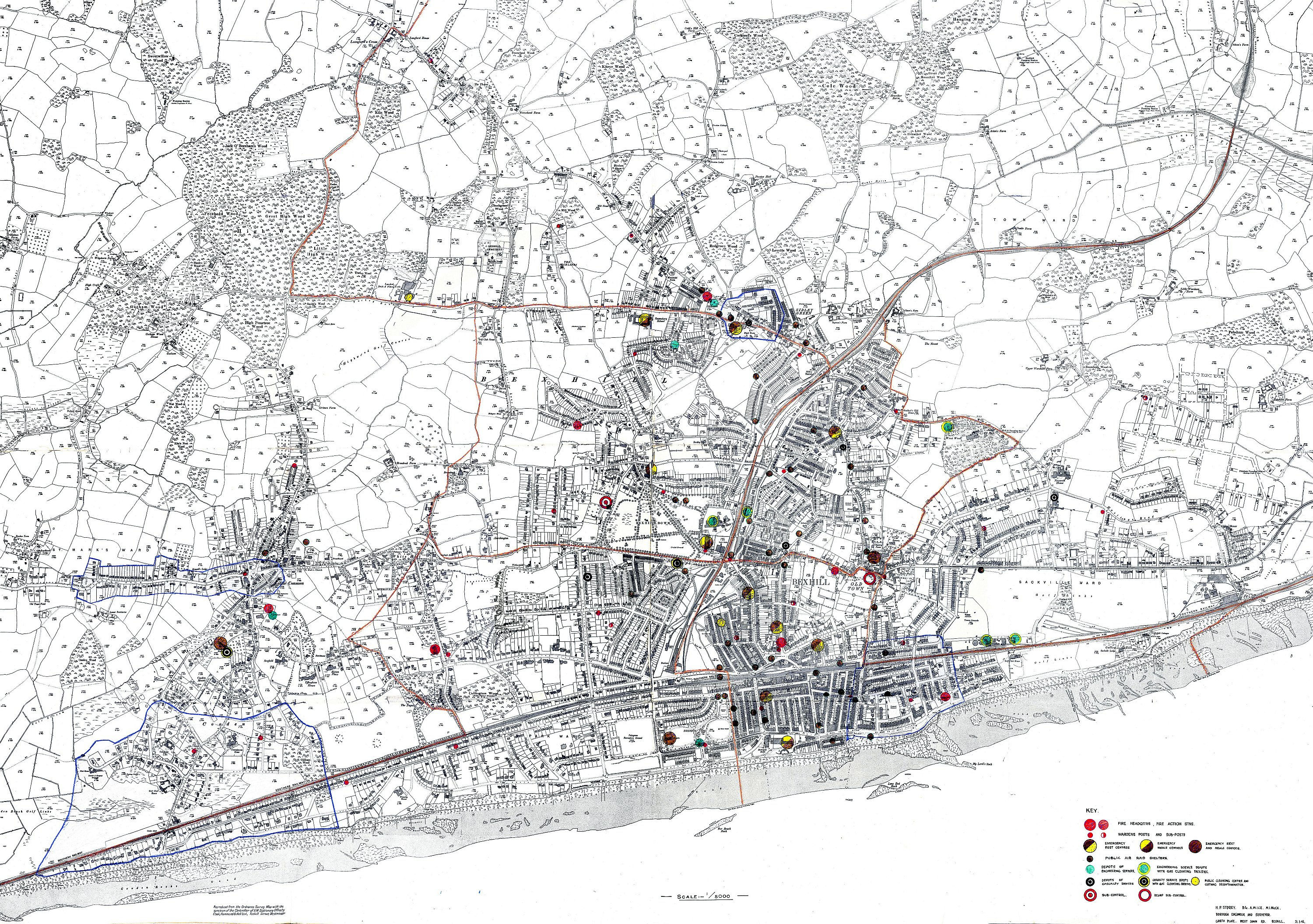
Twenty-one civilians and one soldier were killed, 81 buildings destroyed, 217 seriously damaged and 4,324 slightly damaged. Among buildings hit were the Town Hall, De La Warr Pavilion, Central Station, Sackville and Metropole Hotels and the Beulah Baptist Church which was saved through the efforts of fire fighters led by the minister. A tip-and-run raid in May 1942 wrecked some business premises in the centre of the town, including the offices and local printing works of the Bexhill-on-Sea Observer, and also St. Barnabas’ Vicarage.
Later in the war, when Bexhill was in ‘bomb alley’, some 48 flying bombs passed over the town during one period of 24 hours. Several which fell in the borough damaged Richmond Road, the Metropolitan Convalescent Home and the The Grange. Early in this crisis Bexhill became a key point in the coastal gunnery defences when the anti-aircraft belt was moved from the southern outskirts of London. This operation was completed in three days and the Chief Signals Officer of Anti-Aircraft Command, Brigadier G. C. Wickins, who was responsible for all the communications, afterwards became a distinguished resident of the town.
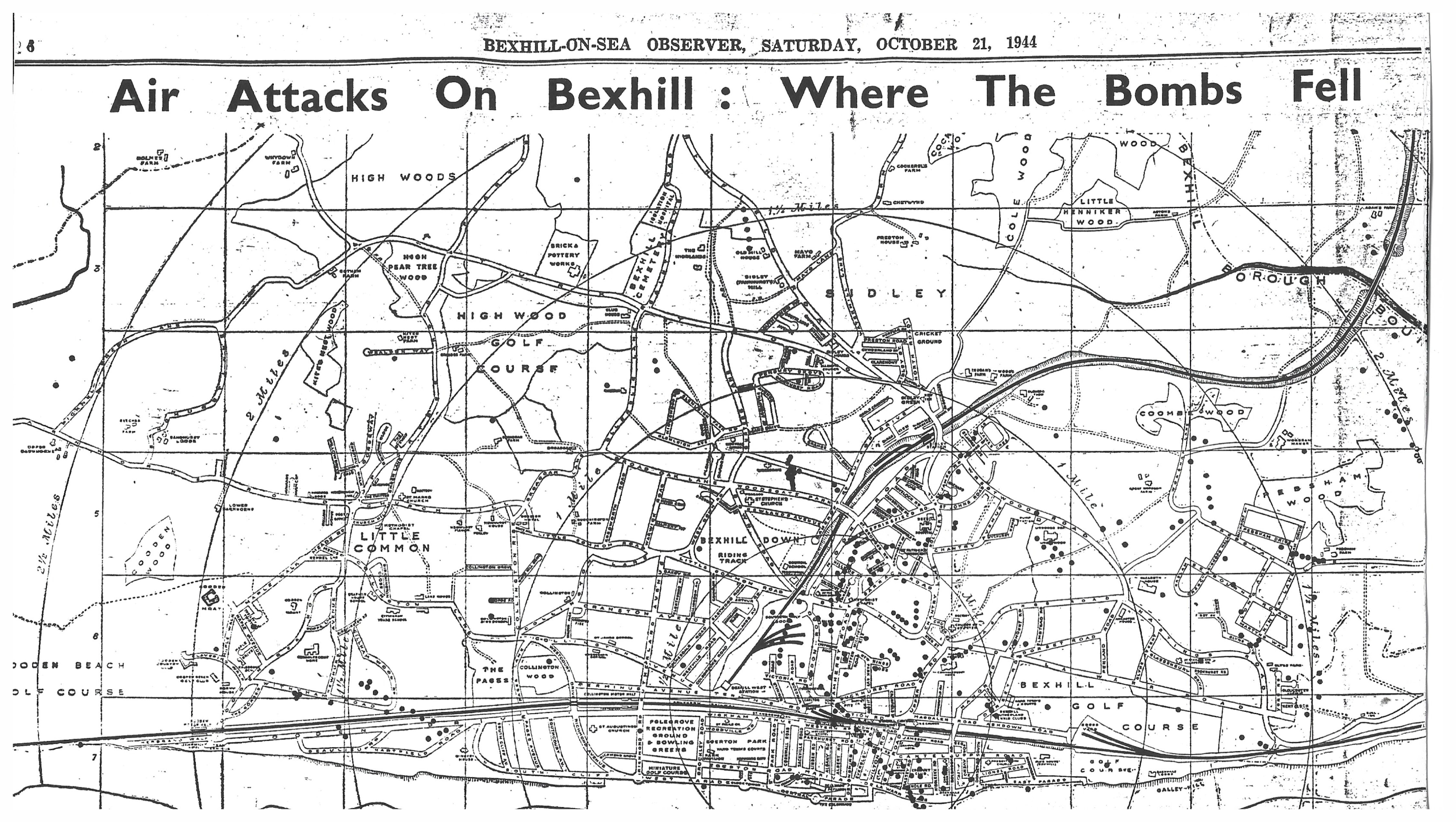
The map above shows where the bombs fell and this covers a large area - click on the image to enlarge it and click again to enlarge it further. There are colour-coded symbols, at bottom right, explaining what fell where.
The Bexhill Observer, in its issue of 21st October 1944 published a map showing where the bombs fell. Because it was a newspaper, with all the problems newspapers had with printing images at that time and with the area of Bexhill it covered being very large, the details were hard to spot. All bombs, whatever their type, were marked with a small black dot, which didn't help.
A digital map of these locations has been created here: https://bexhill-osm.org.uk/ww2
The report in the newspaper says,
"Three hundred and twenty-eight high explosive bombs have been dropped on Bexhill during. 51 raids by enemy aircraft since 1940. The dots on this map show where they fell in the borough and also where 12 flying bombs came down, but for security reasons these latter are not separately identified. In addition, about 1,000 incendiaries have boon showered on the town and some oil bombs."
"The trails of the earlier and more concentrated attacks are easy to trace on the map. One will be seen running diagonally across the centre of the town. Another traversed the London-road housing estate, and a third extended from St. David's-avenue down Amherst-road to the south of the railway line. Other sticks of bombs are also clearly indicated. These were dropped in the days before the defences were built up and enemy planes roamed the skies almost at will. Later attacks by tip-and-run raiders, which were met by gunfire and fighters, were more scattered in their effect."
"The preparation of the map has been made possible by the help of the A.R.P. authorities and the Borough Surveyor's staff, and this co-operation is greatly appreciated."
Changes in the 20th Century
A growing population with changing housing needs Major Expansion
By 1890 a rapid expansion had taken place. The Devonshire and Sackville Hotels were built followed by the Town Hall (1895). Building societies and estate agents were flourishing.
The first private school was built (Holmwood in Hastings Road), followed by many others. By 1895 there were sixteen.
There was an influx of agricultural workers from the surrounding area, but also "immigration" from London and Ireland: builders, decorators, bakers, butchers, dressmakers, laundry workers, cabinet makers, carriage builders, hotel employees and domestic assistants.
Interwar Expansion
Development, mainly westwards, took place on farmland (Whitehouse estate in the north of the town) or on large private estates becoming uneconomical (Collington area).
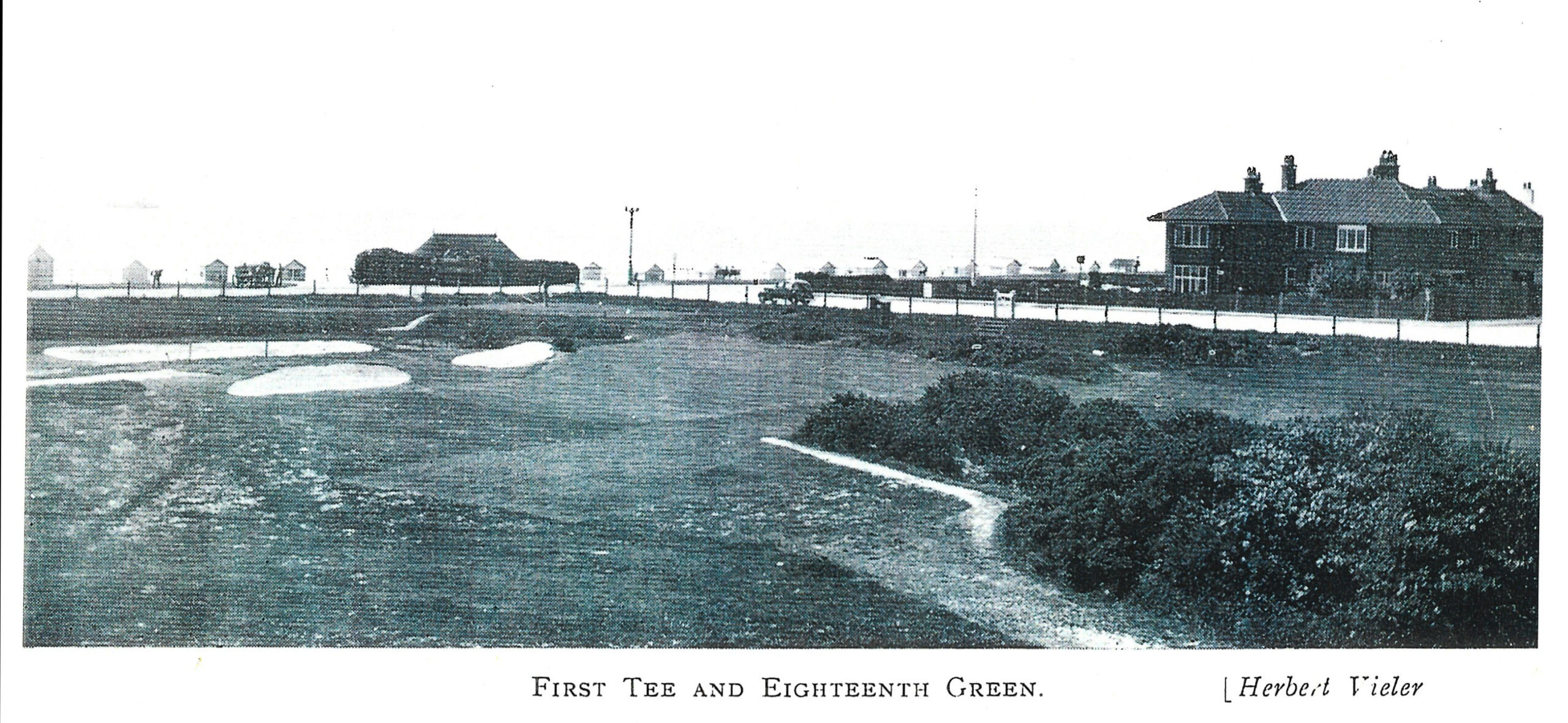
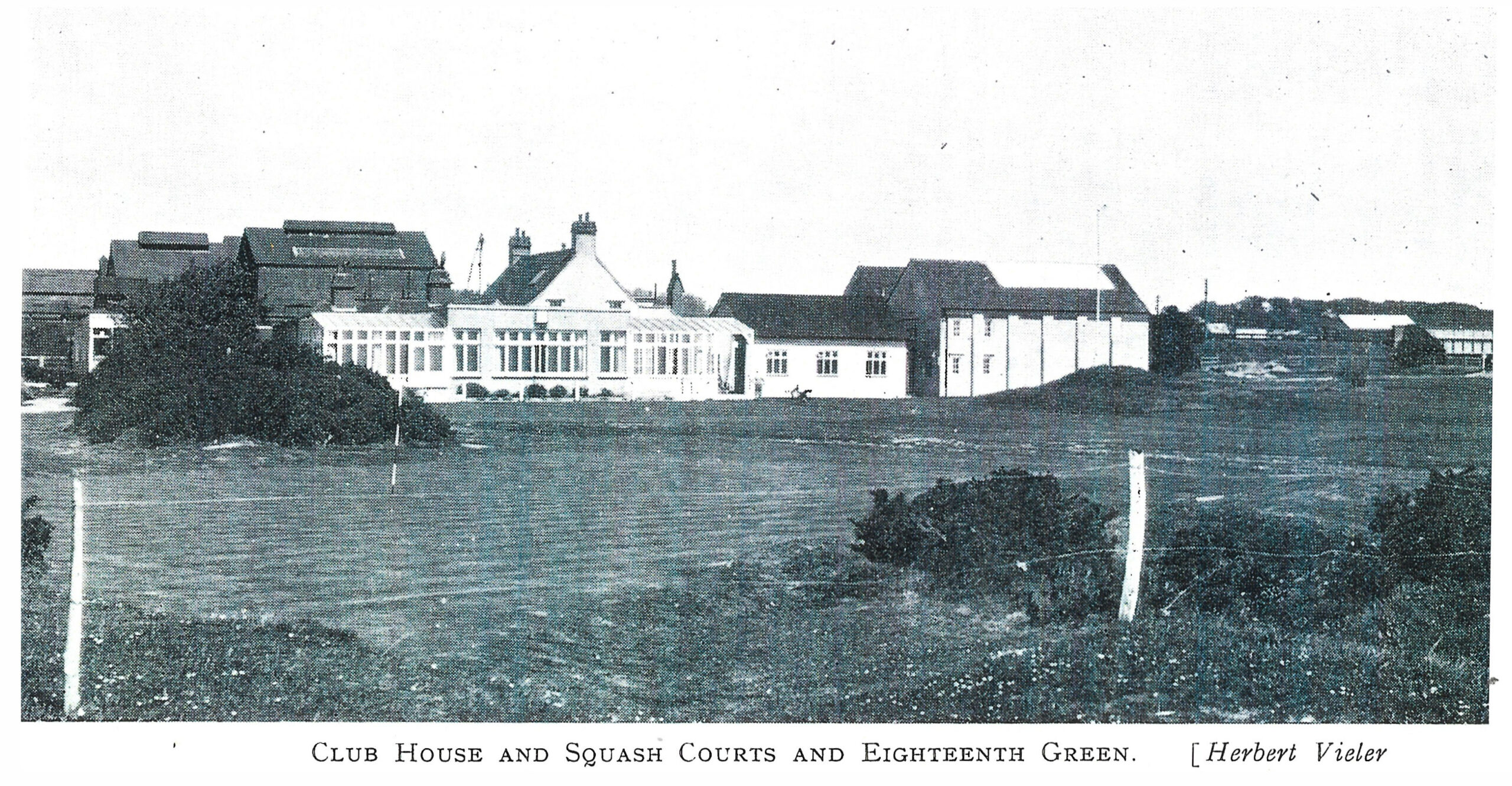
High-class residences were built on De La Warr land in conjunction with the creation of Cooden Beach Golf Club.
Little Common was emerging from its rural state with ribbon developments along an improved Barnhorn Road and Pear Tree Lane.
In the 1930s, the small semi-detached became fashionable, as well as bungalows.
Post Second World-War Expantion
The building boom related to a new class of people - the "retired immigrants". 95% of the over-60sb originated from the London suburbs.
Estates of bungalows were built. Many large private schools closed in the 1960s and the properties converted for housing.
Council building in the 1950s was mainly located north of Sidley (Ingram's and Southland's estates).
Salisbury Road
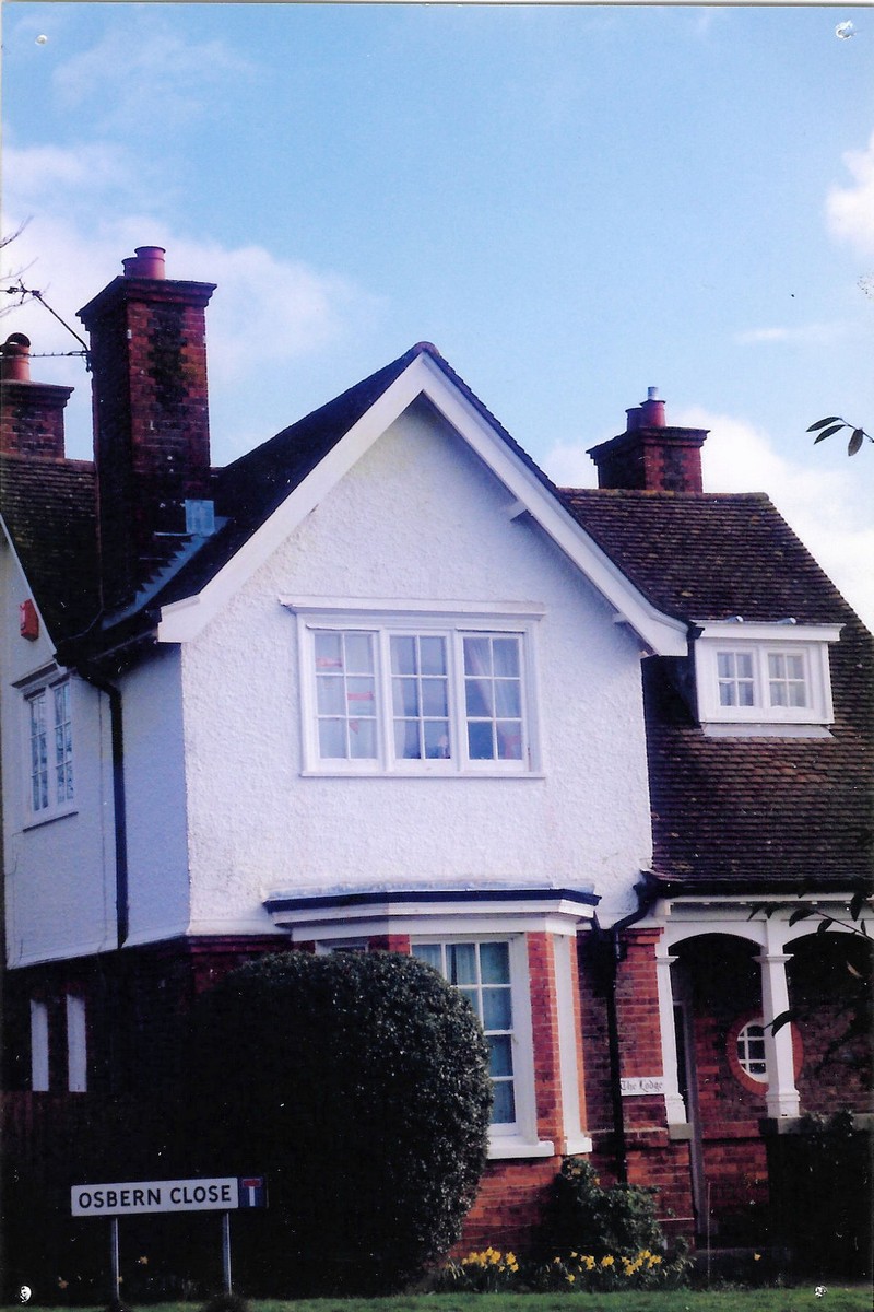
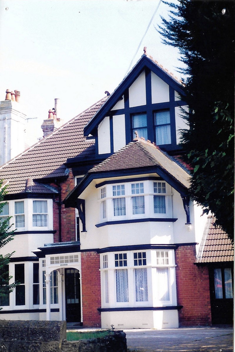
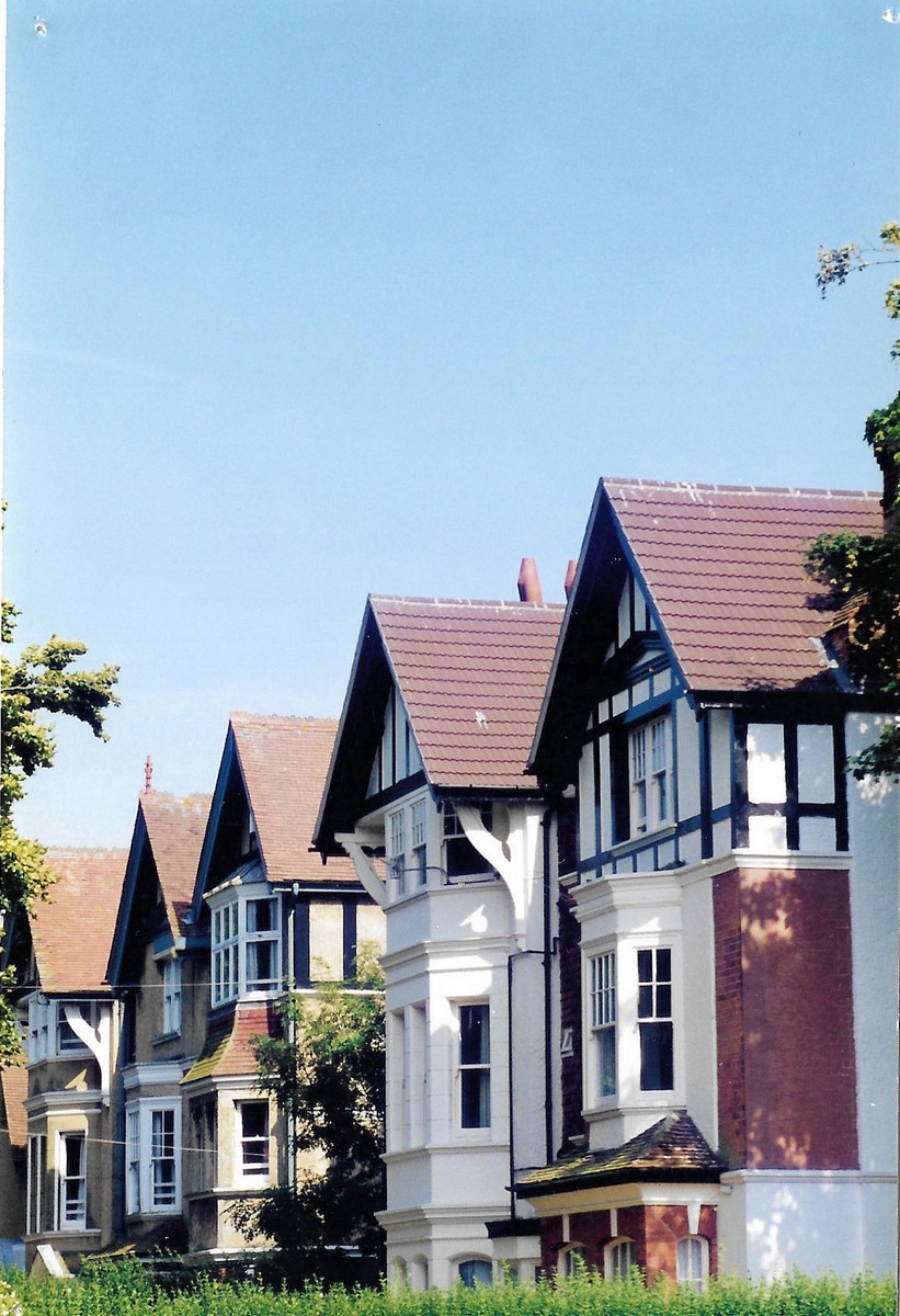
Osbern Road & Hastings Road
The left-hand image is of the Gate House, Osbern Road; the other two are both on Hastings Road
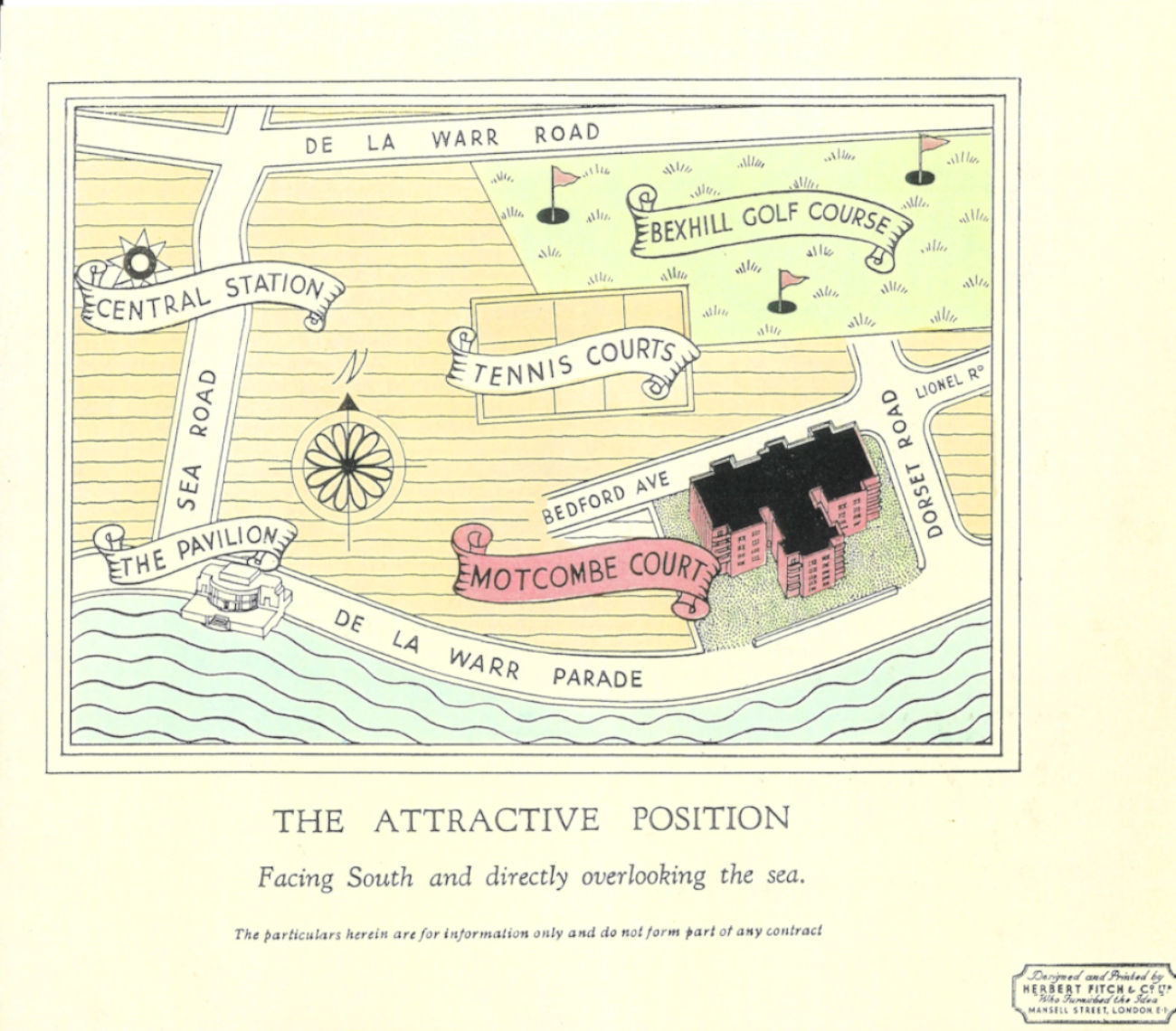
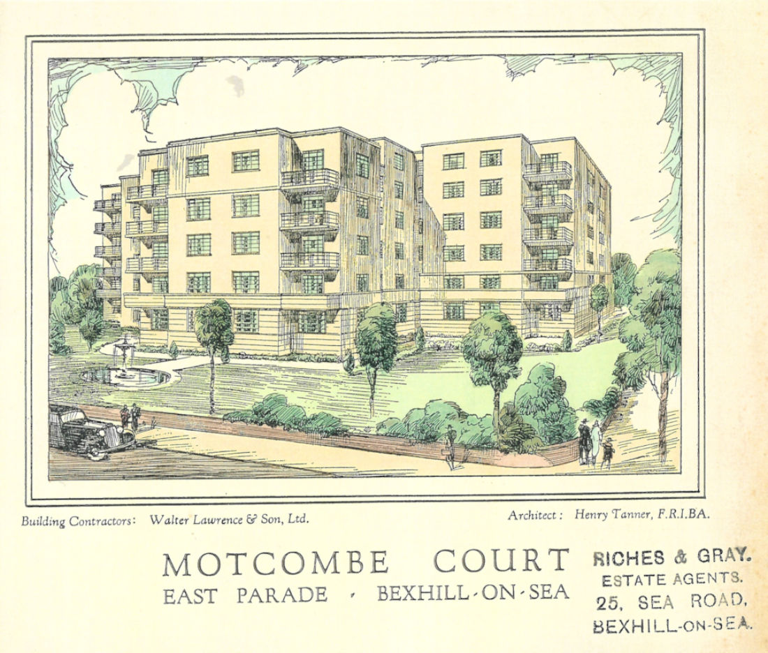
Motcombe Court
More Recent Trends
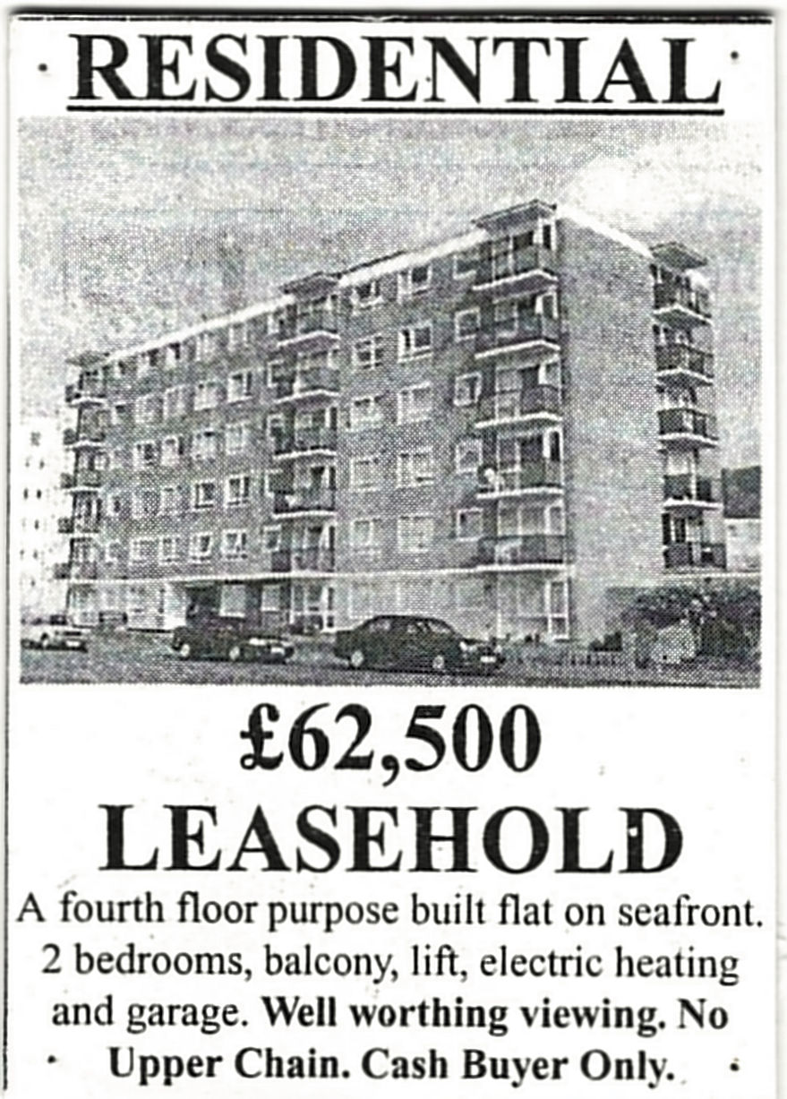
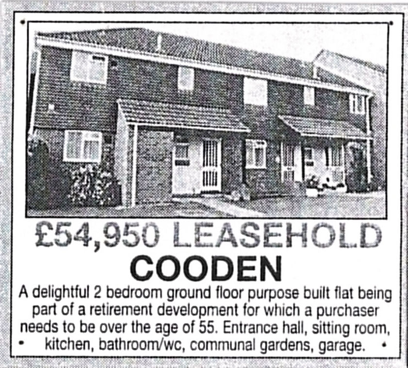
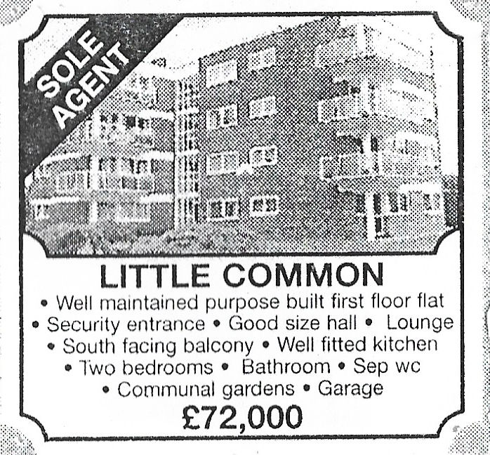
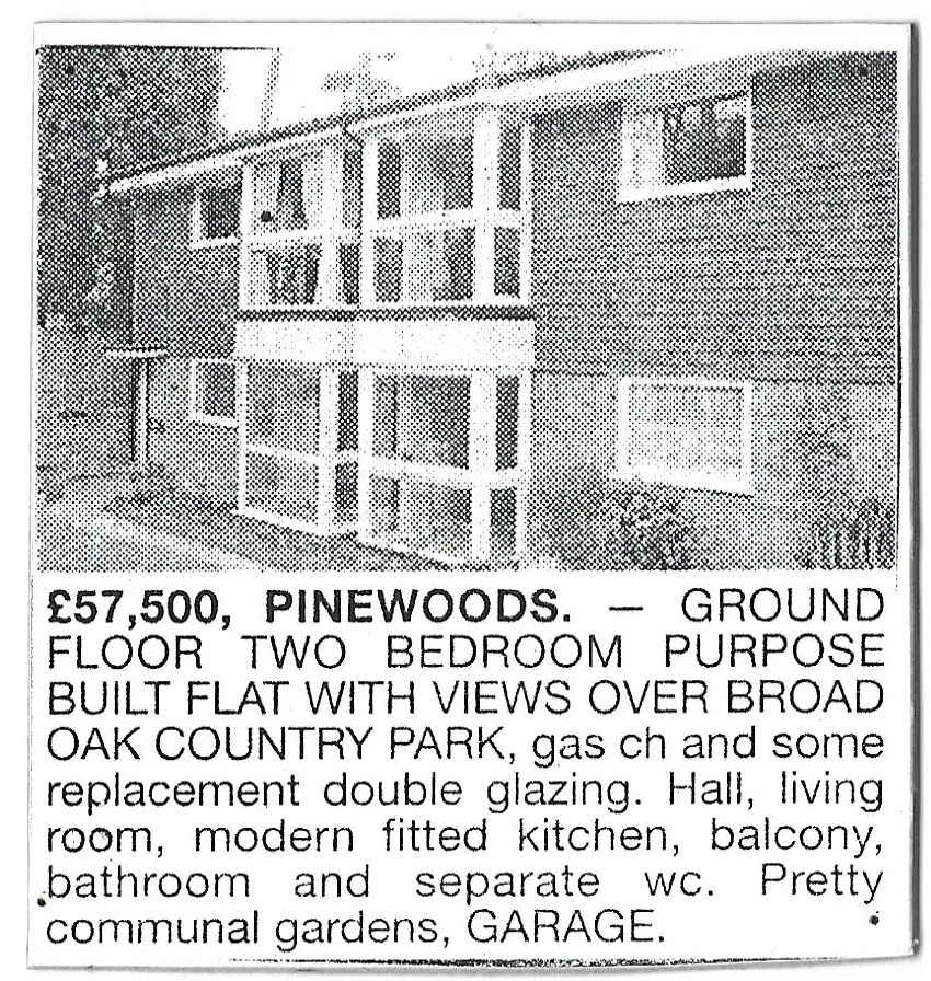
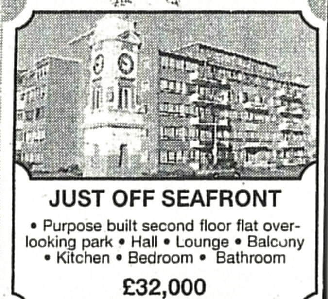
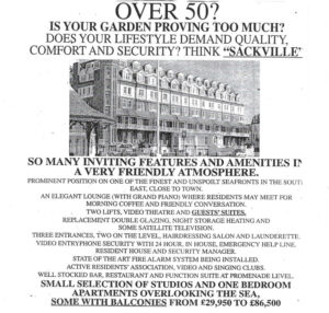
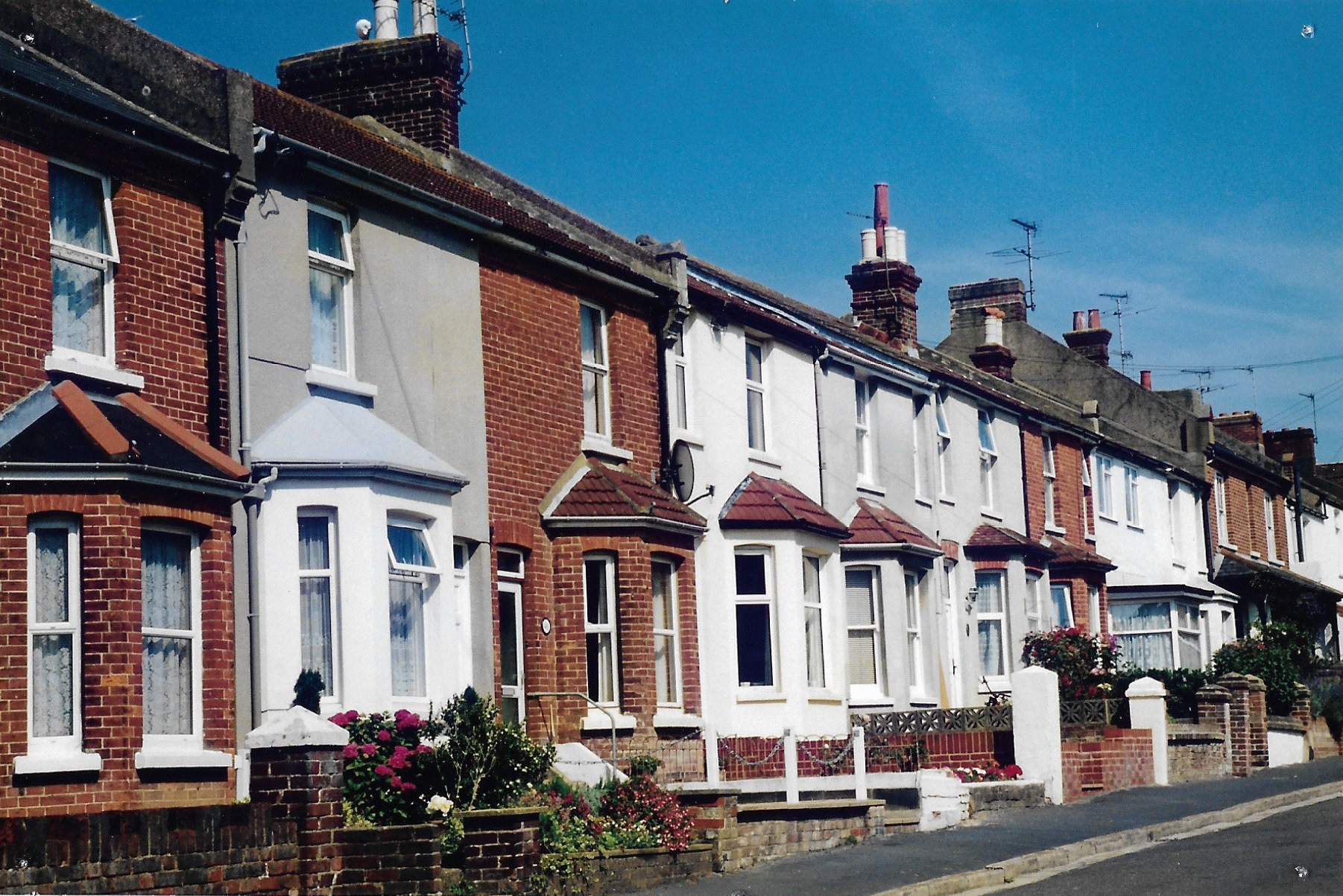
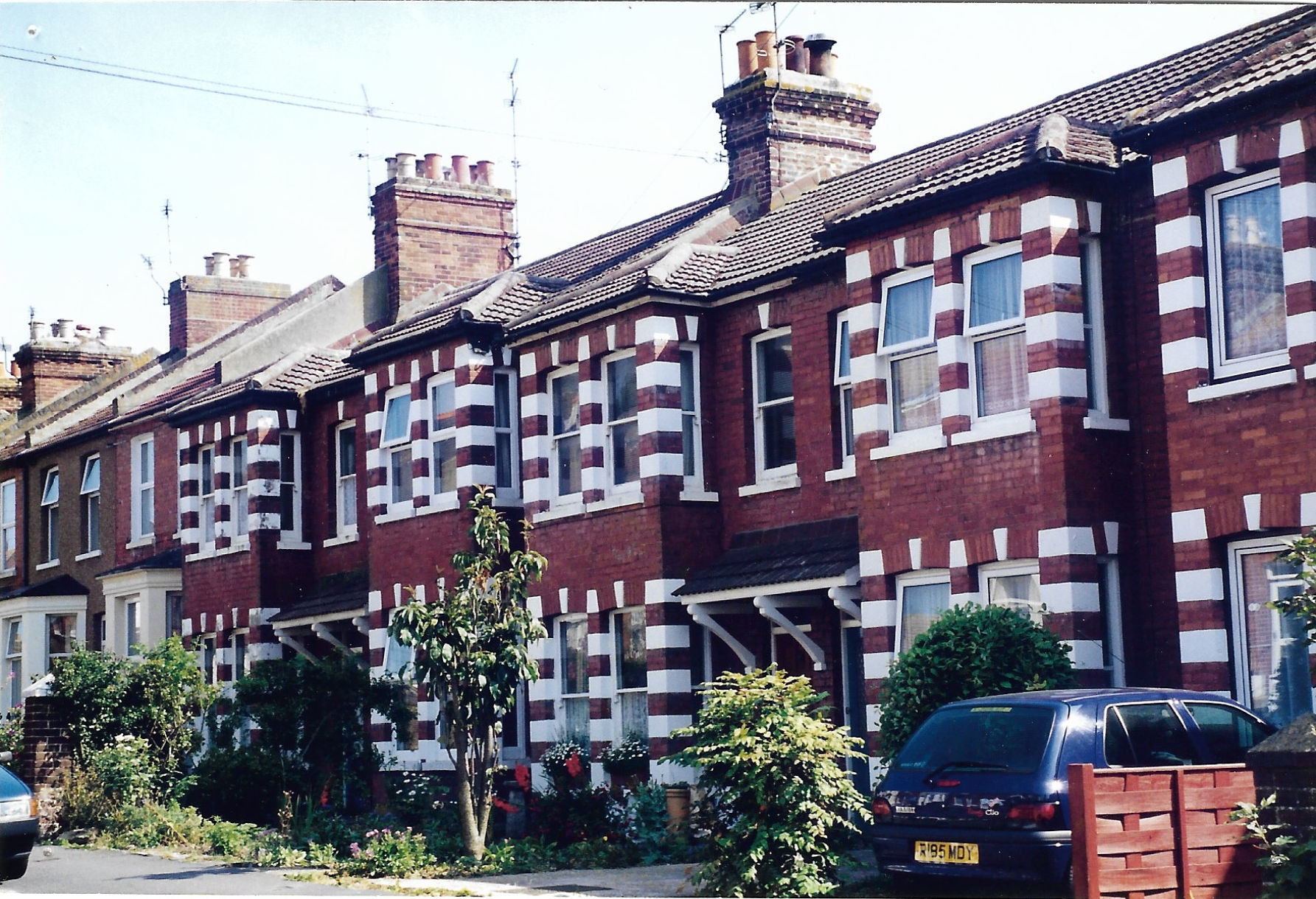
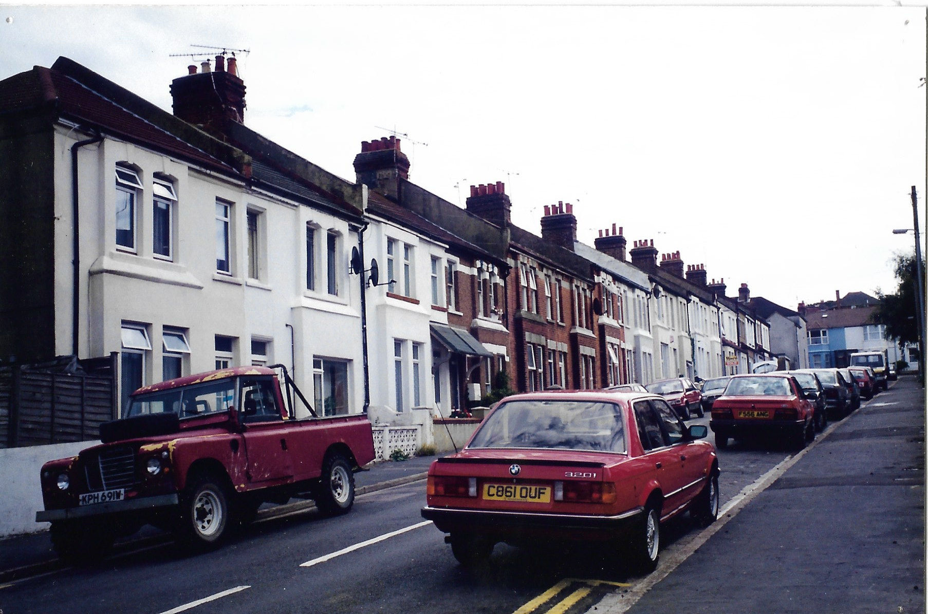
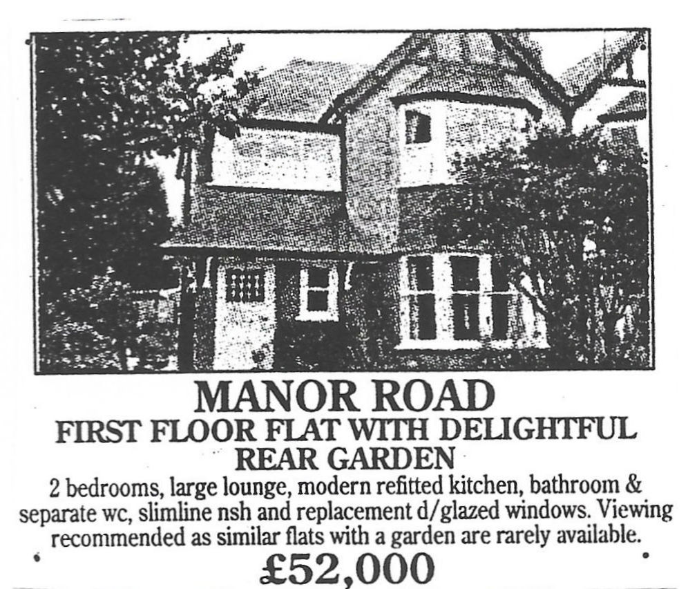
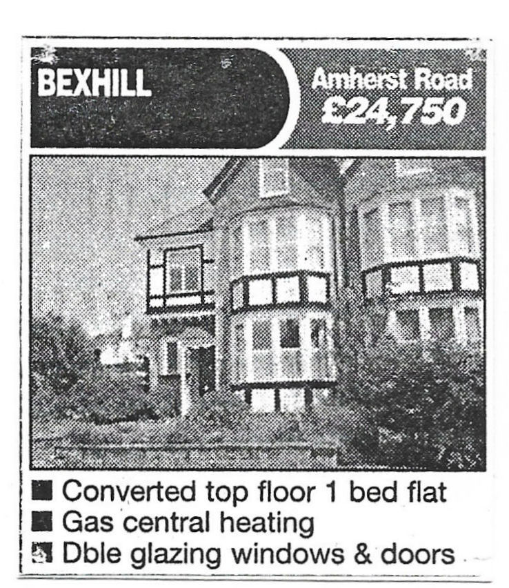
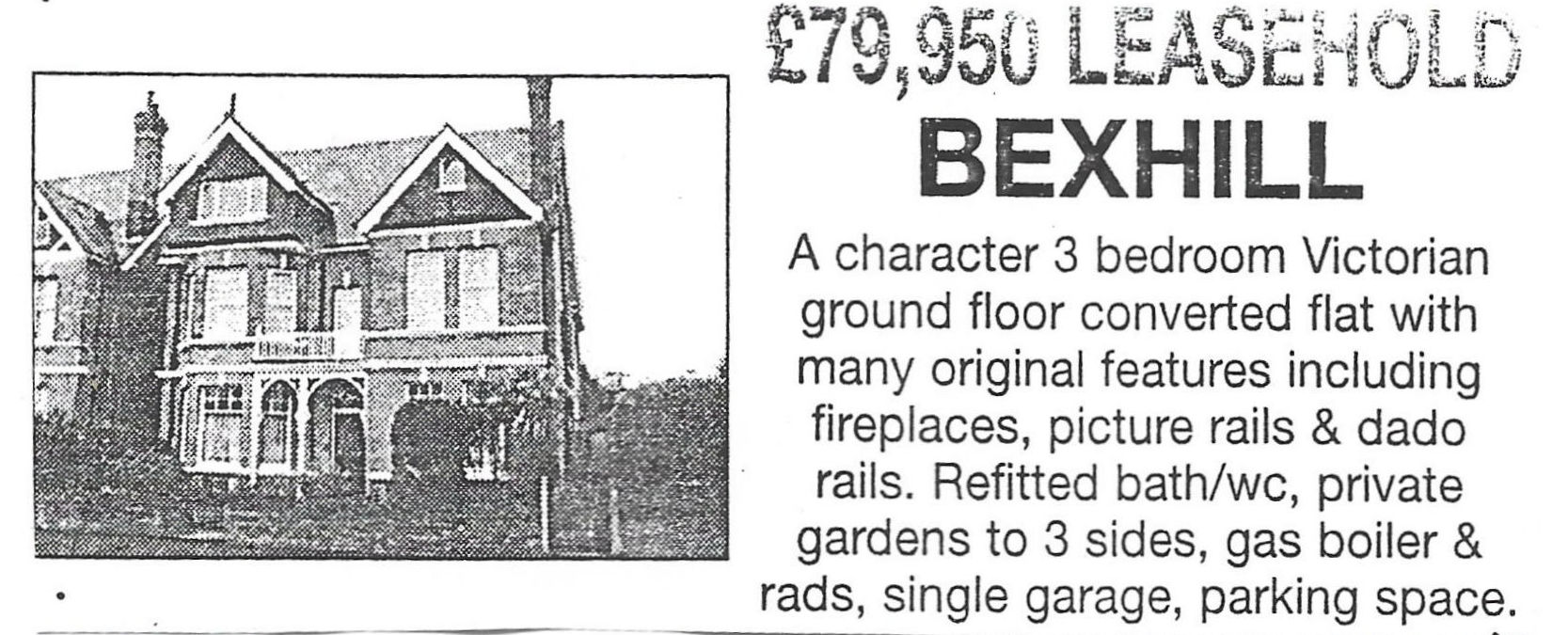
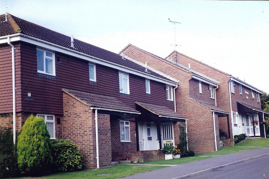
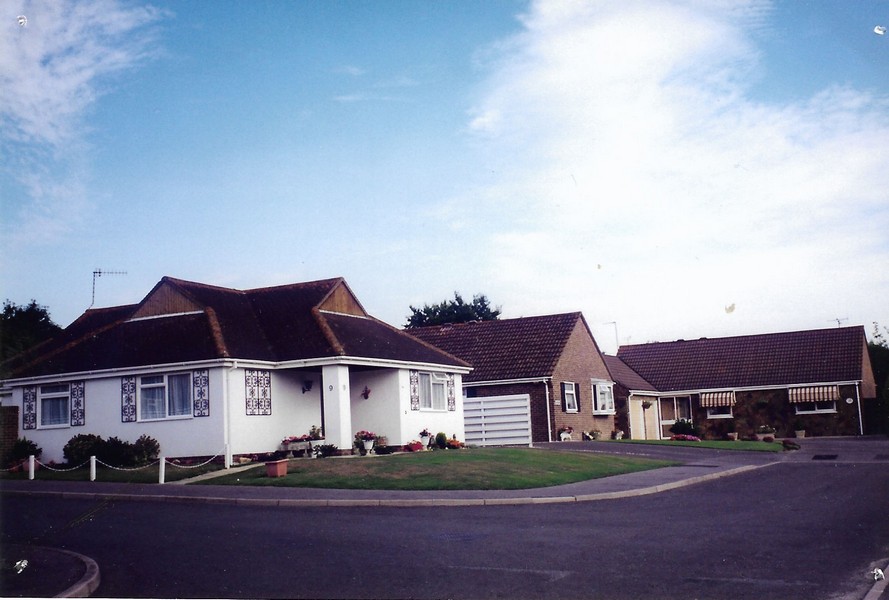
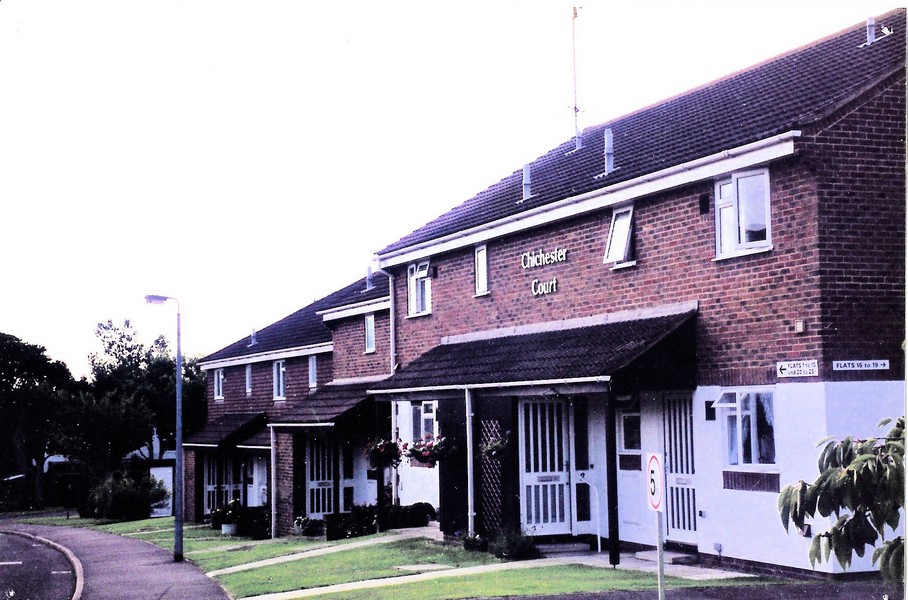
Many older properties becoming uneconomical have been converted into flats. Following an increase in the number of elderly people living on their own, many large Victorian villas have been demolished and replaced by small blocks of flats. Some large houses continue to be used as convalescent and nursing homes. 19th Century artisan and rural housing began to be upgraded. Purpose-built sheltered housing appeared. [See images below]
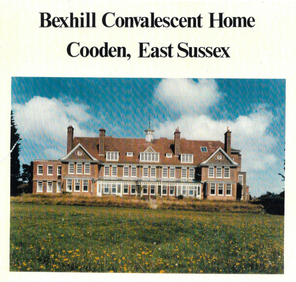
Bexhill Convalescent Home, Cooden
This home was built in 1901, as a convalescent home. When it opened, in 1905, the existing home in Old Town became 'ladies only'. It was, finally, demolished in 1961 and bungalows and sheltered housing were built on the site. [See three Osbern Close photographs on the right]
More examples of the change in the housing requirements up to the present day. Freehold and leasehold flats, from as part of a larger residence or as part of a very large 'purpose-built' or converted residential complex .
Arundel Hotel on Park Avenue